10 places to visit in the Yusufeli district of Artvin: Barhal (Altıparmak) Church, Çoruh River Rafting Course and Barhal River Rafting Area. Plan your trip to Yusufeli with local food, practical tips and transport information.

Share with friends

Yusufeli is a district of Artvin province in Türkiye’s Black Sea Region. The district covers 2,261 km² and has an average elevation of 796 metres above sea level.

Geography

Kaçkar Mountain, in the north-west of the district, rises to 3,937 metres and is the highest mountain of the Northeast Anatolian Mountains.

History and Culture

Yusufeli was founded in 1879 as the Kiskim district, attached to Erzurum province. In 1912 the district was renamed Yusufeli. Because of the dams built on the Çoruh River, the district was relocated again in 2023. Barhal Church was converted into a mosque in 1677 by Hacı Şerif Efendi. The church in Altıparmak village was built during the time of King David Magistros.

Highlights

In 1955, during road construction, a copper axe was found in Nizgavan (Demirköy) village in Yusufeli. The first district administration was set up in 1879 under the name Kiskim district, attached to Erzurum province.

Last updated:

Places to Visit in Yusufeli

  • 2 Historic
  • 1 Religious
  • 2 Nature
  • 5 Attraction

Historic Sites 2

Historic

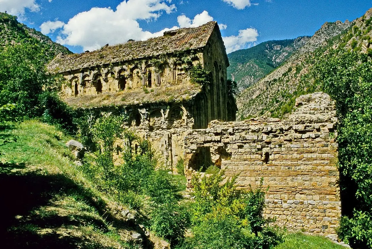
Barhal (Altıparmak) Church

Built in the 10th century during the Kingdom of Georgia, Barhal Church is one of the most important religious buildings of the Tao-Klarjeti region. Its stonework and architectural details make it an outstanding example of Georgian medieval architecture.

View on map
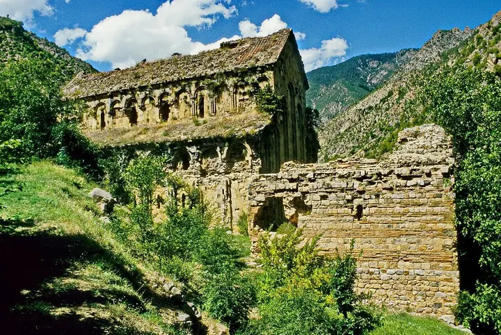
Dörtkilise (Otkhta Eklesia) - Yusufeli Photo: Volker Höhfeld (CC BY-SA 4.0) · Source
Historic

Dörtkilise (Otkhta Eklesia)

Dörtkilise, in Tekkale village attached to Yusufeli, is one of the four great cathedrals of the Tao-Klarjeti region. Dating to the 10th century, the building is one of the monumental examples of Georgian medieval architecture.

View on map

Religious Buildings 1

Religious

Barhal Church

The church in Altıparmak village was converted into a mosque in 1677. It is temporarily closed for restoration.

View on map

Natural Wonders 2

Nature

Yaylalar Village

A plateau village 62 km from Yusufeli, at the foot of the Kaçkar Mountains. Accommodation is available in the village.

View on map
Nature

Aros Plateau

A plateau in Kılıçkaya town, 28 km from the centre, where a festival is held every year in the second week of July.

View on map

Attractions 5

Attraction

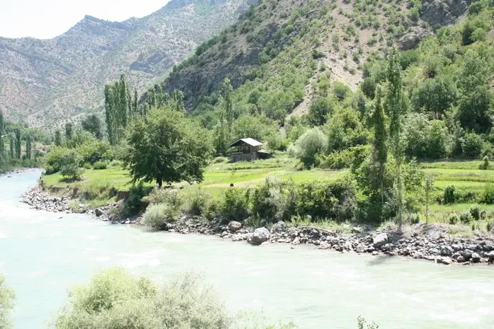
Çoruh River Rafting Course

The Yusufeli stretch of the Çoruh River, one of the fastest-flowing rivers in the world, hosts international rafting competitions. The 150 km course offers sections of different difficulty for professional and amateur rafters.

View on map
Attraction

Barhal River Rafting Area

The 85 km-long Barhal River, rising in the Kaçkar Mountains, joins the Çoruh River at Yusufeli. A 20 km section is used for rafting and kayaking; May and June are the ideal months.

View on map
Yusufeli Dam - Yusufeli Photo: Pedder65 at English Wikipedia (CC BY-SA 3.0) · Source
Attraction

Yusufeli Dam

Built on the Çoruh River, the Yusufeli Dam, with a body height of 275 metres, is the highest dam in Türkiye. Because of the dam, the old district centre of Yusufeli was flooded and a new settlement was built.

View on map
Attraction

Barhal River (Altıparmak village)

The Barhal River within the boundaries of Altıparmak village is promoted for water sports. 3 guesthouses in the village offer accommodation.

View on map
Attraction

Çoruh River

Tours and international competitions are held around Yusufeli between May and August.

View on map

Places to Visit Around Artvin Province

See all →

While you are in Yusufeli, you can also see the highlights of Artvin province. These places are in other districts.

  • Artvin Castle — Known locally as Livane Castle, it was built in 937 by the Georgian king Ashot the Great and controlled the approach to the town and traffic along the Çoruh.
  • Kafkasör Plateau — A forest-ringed highland pasture at an altitude of about 1,200 metres, 12 km from the city centre; it hosts the bull wrestling of the annual Kafkasör Culture, Tourism and Arts Festival.
  • Hatila Valley National Park — A narrow V-shaped valley, in places a canyon, 10 km from Artvin centre; slopes reach gradients of up to 100 per cent in places.
  • İşhan Monastery — A Georgian monastery in the village of İşhan in Yusufeli; it was founded in the 9th century by the monk Saba on the site of a 7th-century church and renovated in 1032 by the architect Ivane Morchaisdze.
  • Dörtkilise (Othta Eklesia) — A 10th-century Georgian monastery 5 km from the village of Tekkale in Yusufeli; its name is a translation of the Georgian Othta Eklesia ("four churches").
  • Barhal (Parhali) Church — The main church of the monastery in the village of Altıparmak in Yusufeli, built between 961 and 973 by the Georgian king David III; a three-aisled basilica measuring 28 × 19 metres, it is one of the best-preserved Georgian buildings in the region.

Practical Information for Visiting Yusufeli

Suggested time
2–3 days
Best time to visit
Spring and summer months (May–September), for rafting May–June
Places to visit
10 places

What to Eat in Yusufeli

Food guide →
  • Kuymak (cornmeal and cheese dish)

    Made with cornmeal, butter and civil cheese, kuymak is Yusufeli's most loved traditional dish. It is served stretching as it is constantly stirred over the fire.

  • Alabalık Izgara (grilled trout)

    Trout caught in the Çoruh River and its tributaries is served grilled or pan-fried. Trout grown in the cold, clean waters of Yusufeli is one of the freshest flavours of the region.

  • Karalahana Sarması (stuffed kale leaves)

    Prepared by wrapping kale leaves around a rice filling, this dish is an essential winter meal in Yusufeli cuisine.

  • Cağ Kebabı (horizontal spit-roasted lamb)

    A news report describes this as a well-known dish of Yusufeli.

Culture, Local Products and Economy of Yusufeli

  • Rafting and Extreme Sports Culture

    Yusufeli is known internationally for its rafting competitions on the Çoruh River. Rafting festivals held every year draw world-class athletes and nature lovers to the district.

  • Tao-Klarjeti Heritage

    Yusufeli was once one of the important centres of the Georgian Tao-Klarjeti region. Structures such as Barhal Church and Dörtkilise are evidence of the rich cultural heritage of that period.

  • New Yusufeli

    With the construction of the Yusufeli Dam, the old district centre was flooded and an entirely new town was built. This process is one of the largest settlement relocation projects in Türkiye.

Local Products

  • Bal (honey) — Honey obtained from the rich vegetation at the foot of the Kaçkar Mountains is known for its high quality. Beekeeping is an important source of income in the area.
  • Alabalık (trout) — Trout raised in the Çoruh River and its tributaries is an important aquaculture product of Yusufeli. Trout grown in cold, clean waters is a valued product of the area.

Economy

The economy of Yusufeli consists of energy production, tourism, livestock and aquaculture. The Yusufeli Dam, the highest dam in Türkiye, produces a significant amount of hydroelectric power. Rafting activities on the Çoruh River and the Barhal River contribute to tourism income. Trout farming and beekeeping are traditional sources of income.

How to Get to Yusufeli

Yusufeli is 80 km from Artvin city centre and 170 km from Erzurum, reached by road. The nearest airport is Erzurum Airport (170 km). There are regular minibus services from Artvin and Erzurum.

Get directions on Google Maps Getting to Artvin

Yusufeli: Frequently Asked Questions

What are the places to see in Yusufeli?

There are 10 highlights in Yusufeli: Barhal (Altıparmak) Church, Çoruh River Rafting Course, Barhal River Rafting Area, Dörtkilise (Otkhta Eklesia), Yusufeli Dam, Yaylalar Village, Aros Plateau, Barhal River (Altıparmak village), Barhal Church and Çoruh River.

What is there to eat in Yusufeli?

Kuymak, Alabalık Izgara, Karalahana Sarması and Cağ Kebabı are the standout flavours at tables in Yusufeli.

What is Yusufeli famous for?

Yusufeli is known for its honey and its rafting and extreme sports culture. Honey obtained from the rich vegetation at the foot of the Kaçkar Mountains is known for its high quality. Beekeeping is an important source of income in the area.

How do I get to Yusufeli?

Yusufeli is 80 km from Artvin city centre and 170 km from Erzurum, reached by road. The nearest airport is Erzurum Airport (170 km). There are regular minibus services from Artvin and Erzurum.

How much time should I set aside for a visit to Yusufeli?

Suggested visit length: 2–3 days. Best time to visit: spring and summer months (May–September), for rafting May–June.

Continue Your Trip

Other Districts of Artvin

Search 81 province guides and 968 district guides.