Beytüşşebap Valleys
The deep valleys surrounding the district, with their rocky slopes and natural vegetation, are striking. The stream running at the bottom of the valley forms a natural pool where people can cool off in the summer.
View on map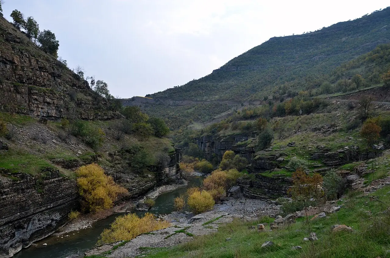 Photo: KediÇobanı (CC BY-SA 4.0) · Source
 4 places to visit in the Beytüşşebap district of Şırnak: Beytüşşebap Valleys, Beytüşşebap Plateaus and Zümrüt Thermal Baths. Plan your trip to Beytüşşebap with local food, practical tips and transport information.
Beytüşşebap is a district of Şırnak province. The district lies about 20 km from the Iraqi and Syrian borders in the south-east of Türkiye’s Southeastern Anatolia Region. Habur Creek, which gives its name to the Habur border gate, rises within the boundaries of Beytüşşebap. The district covers an area of 1,647 km².
As a word, Beytüşşebap is an Arabic compound name derived from the words Beyt and Şebap, and means the house of the young men. According to other sources, the name Beytüşşebap comes from Syriac, meaning beth şabath (place of the Sabbath). The original Beytüşşebap that gave its name to the district is today the village of Hisarkapı.
Over the course of history the district was ruled by the Hurrians, Mitanni, Assyrians and Urartians. It came under Seljuk rule in 1054 and Ottoman rule in 1514. Attached to Erzurum province in 1855 and to Van province in 1865, Beytüşşebap became a district in 1887. After the proclamation of the Republic it was attached to Siirt in 1926, to Hakkari in 1936, and to Şırnak in 1990.
The district has a mountainous terrain; it is bordered by Hakkari to the east, Siirt-Pervari to the west, Van-Çatak to the north, and Hakkari-Çukurca and Şırnak-Uludere to the south. The Altın Mountains to the east of the district and the Tanin Mountain to the west intersect within the district boundaries. The Kato Plateau is located in the district. The average elevation of the district centre above sea level is 2,566 metres; the highest point of the district is the Kato Plateau, which exceeds 3,000 metres. The district’s climate has the harsh characteristics of Eastern Anatolia.
The 2020 population of Beytüşşebap district is 16,317. The population of the district centre is 5,690, and the total population of the towns and villages is 10,627.
Beytüşşebap became a district in 1887, after being attached to the provinces of Erzurum and Van in 1855 and 1865. Throughout history the district was ruled by the Hurrians, Mitanni, Assyrians and Urartians. The name Beytüşşebap comes from the Arabic words ‘Beyt’ and ‘Şebap’.
Last updated:
The deep valleys surrounding the district, with their rocky slopes and natural vegetation, are striking. The stream running at the bottom of the valley forms a natural pool where people can cool off in the summer.
View on mapThe plateaus in the upper parts of the district are favoured in the summer for their cool air and natural beauty. Each summer the local people hold traditional plateau festivals to keep their cultural heritage alive.
View on mapIn Ilıcak village, a thermal bath with water at 39 degrees; it is said to be good for skin, kidney and rheumatism conditions.
View on mapThe most important watercourse of the district; it gives its name to the Habur border gate.
View on mapWhile you are in Beytüşşebap, you can also see the highlights of Şırnak province. These places are in other districts; Beytüşşebap is about 100 km from the provincial centre.
Beytüşşebap Honey was registered as a protected geographical indication on 8 May 2025 (TÜRKPATENT registration no: 1738). Product group: honey. Registered by: Beytüşşebap District Directorate of Agriculture and Forestry.
A product registered with TÜRKPATENT as a protected geographical indication.
Beytüşşebap is a district that keeps up its traditional rural way of life. This tradition is passed down from generation to generation as an important element of the local people's cultural identity.
Beytüşşebap's economy is based on livestock farming and agriculture. Small livestock farming is the main source of livelihood.
Beytüşşebap is 100 km from Şırnak city centre and 80 km from Hakkari.
The 4 highlights of Beytüşşebap: Beytüşşebap Valleys, Beytüşşebap Plateaus, Zümrüt Thermal Baths and Habur Creek.
Beytüşşebap Honey and Beytüşşebap Sehleber Kebabı are the standout flavours on Beytüşşebap's tables.
Beytüşşebap is known for Beytüşşebap Jirki Kilim and its rural way of life tradition. It is registered with TÜRKPATENT as a geographical indication product.
Beytüşşebap is 100 km from Şırnak city centre and 80 km from Hakkari.
Suggested visit length: half a day. Best time to visit: spring and summer.