 Photo: Timo Roller (CC BY 3.0) · Source
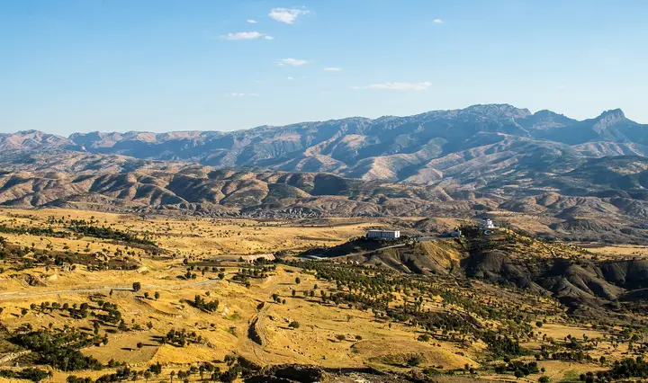
 Mount Cudi
A mountain 2,144 metres high in the Silopi district; in Early Christian and Islamic tradition it is named as the place where Noah's Ark landed after the Flood.
View on map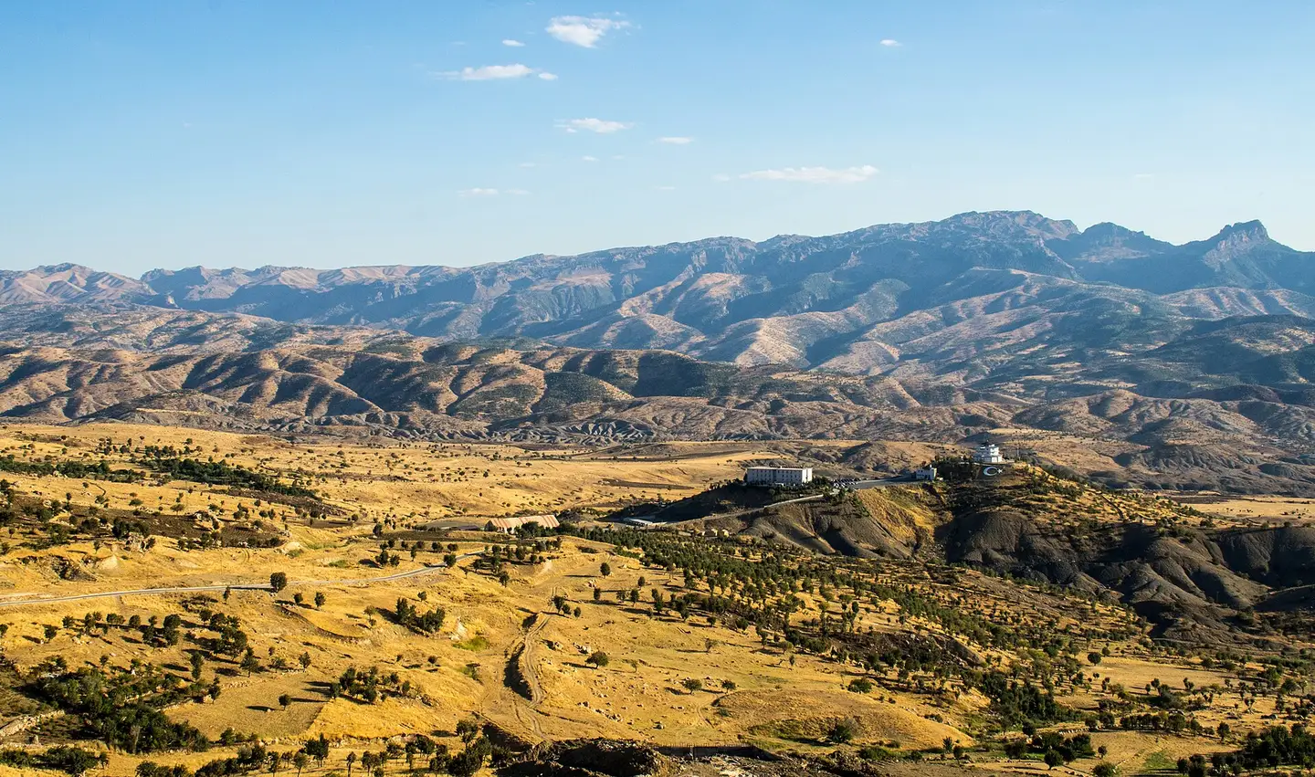 Photo: Timo Roller (CC BY 3.0) · Source
 Şırnak is the province of Mount Cudi, where Noah's Ark is believed to have landed after the Flood, of Cizre on the Tigris, and of the inventor al-Jazari, remembered for his early robotics. The Cizre Grand Mosque and Castle and the highland pastures of Silopi, Beytüşşebap and Uludere stand out. Cizre meyre, Silopi behnat figs, Beytüşşebap honey and Beytüşşebap jirki kilim have registered geographical indications.
Last updated:
7 places worth seeing in Şırnak, from historic monuments to natural wonders, grouped by type. Open any of them on the map with a single click.
Photo: Timo Roller (CC BY 3.0) · Source A mountain 2,144 metres high in the Silopi district; in Early Christian and Islamic tradition it is named as the place where Noah's Ark landed after the Flood.
View on map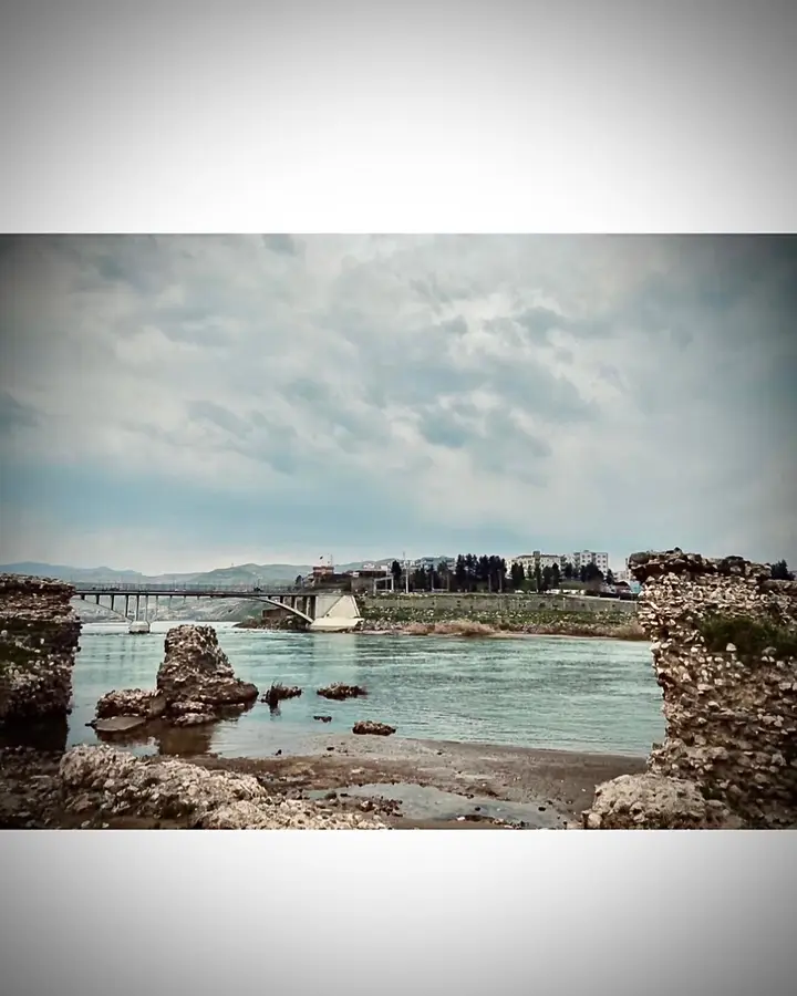 Photo: Ayşe Gizem Güleç (CC BY-SA 4.0) · Source
 Cizre lies on the right bank of the Tigris, where the river bends and forms a water island; its name comes from the Arabic word jazira, meaning 'island'.
View on map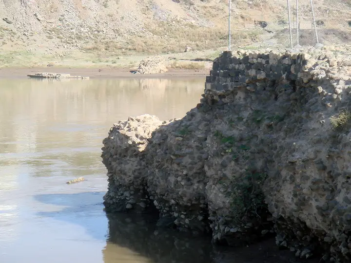
A ruined castle on the bank of the Tigris, made up of an inner and an outer fortress. It was used by a military unit until 2010 and was restored in 2012.
View on map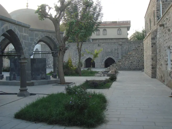 Photo: MikaelF (CC BY-SA 3.0) · Source
 A historic mosque in the Dağkapı neighbourhood, thought to have been converted from a church in the 7th century; its round-bodied minaret was built in 1155. Its bronze door is among the important works of the art of carving.
View on mapSilopi (517 m) was a settlement attached to ancient Nineveh; the hamlet of Yankale has the remains of an Assyrian-period castle.
View on mapA high-altitude district covering 1,647 km². The Habur Stream, which gives its name to the Habur Border Gate, rises here, and there is a hot spring.
View on mapŞırnak lies in the far south-east of the Southeastern Anatolia Region, on the Iraqi border, in a province where mountains and valleys interlock. The city centre takes its name from Şehr-i Nûh (the City of Noah), and it is built to the north of Mount Cudi (2,144 metres; within the boundaries of Silopi), the mountain said to be where Noah’s Ark landed. Cudi is named in Early Christian and Islamic tradition as the mountain where the ark came to rest after the Flood, and its name also appears in Sumerian and Babylonian inscriptions.
The province’s historic town, Cizre, was founded on the right bank of the Tigris, where the river bends and forms a water island; its name comes from the Arabic word jazira, meaning “island”. There is archaeological evidence that Cizre has been settled since the Neolithic period. The town was attached to Mardin from the early years of the Republic, until it was attached to Şırnak on 16 May 1990. Cizre’s best-known son is the inventor İsmail el-Cezerî (al-Jazari), who was born in Cizre in 1136 and described about 50 mechanical devices; he is regarded as having taken the first steps of cybernetics.
The first building of the Cizre Grand Mosque is thought to date from the 7th century, when a church was converted into a mosque; its round-bodied minaret was built in 1155. The other districts of the province, Silopi, Uludere, Beytüşşebap, İdil and Güçlükonak, are known for their high mountains, highland pastures and border gates (Habur).
Summers in Şırnak are very hot and dry, winters cold and wet. Averages for 1970–2025 from the Turkish State Meteorological Service:
| Month | Avg. high | Avg. low | Rainfall | Rainy days |
|---|---|---|---|---|
| January | 6.2 °C | −0.5 °C | 96 mm | 10 |
| February | 7.5 °C | 0.4 °C | 98 mm | 10 |
| March | 11.4 °C | 3.9 °C | 120 mm | 11 |
| April | 16.9 °C | 8.6 °C | 104 mm | 10 |
| May | 22.8 °C | 13.7 °C | 57 mm | 8 |
| June | 29.6 °C | 19.8 °C | 6 mm | 2 |
| July | 34.0 °C | 24.0 °C | 4 mm | 0 |
| August | 33.9 °C | 24.0 °C | 1 mm | 0 |
| September | 29.5 °C | 19.8 °C | 10 mm | 1 |
| October | 21.9 °C | 13.3 °C | 45 mm | 6 |
| November | 13.9 °C | 6.4 °C | 83 mm | 7 |
| December | 8.4 °C | 1.7 °C | 92 mm | 9 |
The best times are April to early June and late September to October. This station takes its measurements for the Şırnak city centre; the Cizre and Silopi plains are hotter in summer, while the highland pastures of Beytüşşebap and Uludere are cooler.
By air: Şırnak Şerafettin Elçi Airport opened on 26 July 2013. It is 10 km from Cizre and 60 km from the provincial centre, and serves domestic flights.
By road: Cizre is linked along the Tigris towards Mardin and Batman; the Habur Border Gate at Silopi is an important gateway to Iraq.
Day 1 – Cizre: The Tigris bank and the view of the bridge, Cizre Castle and the Grand Mosque; in the evening, meyre, luzine dessert and Memilheva biscuits.
Day 2 – Silopi and Cudi: The area around Mount Cudi; behnat figs at Silopi.
Day 3 – Beytüşşebap: The highland pastures and hot spring; Beytüşşebap honey and jirki kilim.
Şırnak cuisine is based on the produce of the Tigris and the mountain highlands. The delicacies with registered geographical indications are Cizre meyre, Cizre leyminete (lemonade), Cizre luzine tatlısı, Cizre Memilheva kurabiyesi (biscuits), Cizre bırınczer, Beytüşşebap Sehleber kebabı, Şırnak Hanuhin tatlısı (dessert), Şırnak Soryaz, Şımşıpe and Şırnak Dergul tahini. The products are Silopi behnat inciri (figs) and Beytüşşebap balı (honey).
The Beytüşşebap Jirki kilimi has a registered geographical indication.
Şırnak province has 7 districts. Explore the places to visit, local dishes and transport in each one.
A local dish with a registered geographical indication.
A kebab with a registered geographical indication.
A dessert with a registered geographical indication.
Biscuits with a registered geographical indication.
A lemonade with a registered geographical indication.
A dessert with a registered geographical indication.
The main stops are the area around Mount Cudi, the Cizre Grand Mosque, Cizre Castle, the Tigris bank, Silopi, Beytüşşebap and Uludere.
Mount Cudi, Cizre (the birthplace of al-Jazari), Cizre meyre, behnat figs and Beytüşşebap honey.
It is in Silopi, 2,144 metres high, and is named as the place where Noah's Ark landed.
He was an inventor and engineer, born in Cizre in 1136, who described about 50 mechanical devices.
April to early June and late September to October are the best times.
The information in this guide has been compiled from and checked against the sources below (last checked: 8 October 2026). If you spot an error, please let us know.