Meydan Madrasa
A madrasa from the period of the Hakkâri Principality in the centre of Hakkâri; it is the city's most important surviving historic building.
View on map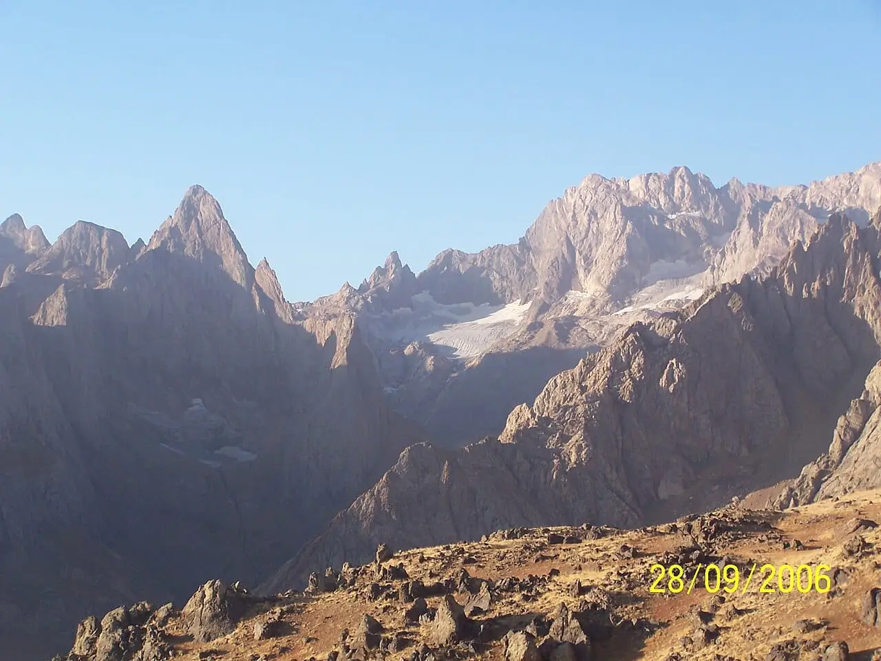 Photo: hamza atılgan (CC BY-SA 3.0) · Source
 Hakkâri is Türkiye's most mountainous province, home to the Cilo and Sat Mountains (declared a national park in 2020) with Uludoruk (4,135 m), Türkiye's second-highest peak, and its largest glaciers, as well as the deep valleys of the Zap River, inverted tulips, Berçelan Plateau and the 3,000-year-old Hakkâri stelae that reflect Eurasian steppe culture. Hakkâri kilim, Şemdinli honey and Yüksekova çirek cheese carry registered geographical indications.
Last updated:
9 places worth seeing in Hakkari, from historic monuments to natural wonders, grouped by type. Open any of them on the map with a single click.
A madrasa from the period of the Hakkâri Principality in the centre of Hakkâri; it is the city's most important surviving historic building.
View on mapA church and the surrounding ruins in the village of Konak, 16 km north of the city centre, which for centuries was the seat of the patriarchs (Mar Shimun) of the Church of the East.
View on map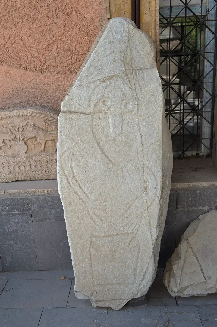 Photo: Dosseman (CC BY-SA 4.0) · Source
 13 stone stelae found in 1998 at the northern foot of Hakkâri Castle and dated to the 15th–11th centuries BC; the slabs, 0.7–3.1 metres high, are carved with warriors carrying daggers, spears and axes, and with female figures. They are among the rare traces of Eurasian steppe culture in the Near East and are displayed today in the Van Museum.
View on map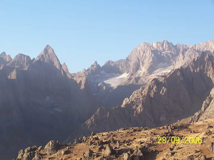 Photo: hamza atılgan (CC BY-SA 3.0) · Source
 A mountain massif whose summits are covered in ice all year round and which includes Uludoruk (Reşko, 4,135 m), Türkiye's second-highest peak; with its five separate glaciers and jagged rocky peaks it is one of the most impressive mountaineering areas in Türkiye. It has lain within national park boundaries since 2020.
View on map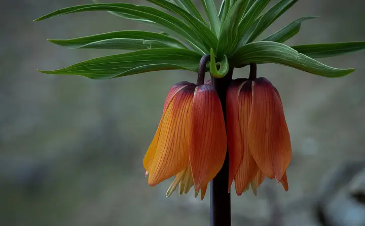 Photo: Engin Tavlı (CC BY-SA 4.0) · Source
 Declared Türkiye's 45th national park on 25 September 2020, the area spreads across the Merkez, Şemdinli and Yüksekova districts and is protected for its glacial lakes, glacial valleys and endemic plants. In spring, inverted tulips (Fritillaria imperialis) cover the slopes.
View on map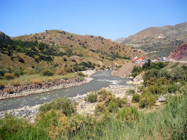 Photo: Caracas (CC BY-SA 3.0) · Source
 A deep valley cut through the Hakkâri mountains by the Zap River; the Van–Hakkâri road and the road to Çukurca follow this valley. With its steep slopes and the remains of historic bridges, it is one of the province's most striking landscapes.
View on map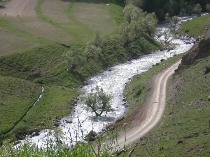 Photo: hamza atılgan (CC BY-SA 3.0) · Source
 A highland pasture (yayla) near the city centre where nomads pitch their tents in summer; with its streams, flowery meadows and a highland festival held every summer, it is the most easily reached nature area in Hakkâri.
View on mapA broad wetland on the Yüksekova plain; an important stopover for migratory and water birds.
View on map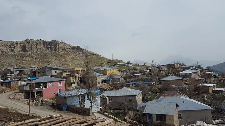 Photo: Semsûrî (CC BY-SA 4.0) · Source
 A district set in a valley between steep mountains, south of Şemdinli; its villages built on the slopes and its mountain scenery are the main attractions.
View on mapHakkâri lies in the south-eastern tip of Türkiye, where the Iraqi and Iranian borders meet, in the highest and most rugged part of the Southeastern Taurus. Almost all of the province is mountainous: the Uludoruk (Reşko) summit of Cilo (Buzul) Mountain, at 4,135 metres, is the second-highest point in Türkiye after Mount Ağrı, and the Cilo and Sat mountains hold the largest glaciers in Türkiye. These mountains were placed under protection on 25 September 2020 as Hakkâri Cilo and Sat Mountains National Park.
The province’s main river is the Zap River: it rises in the mountains east of Van, passes close to the city of Hakkâri through a deep gorge and joins the Tigris in Iraq. The city centre itself sits in a narrow valley carved by tributaries of the Zap, at an altitude of about 1,700 metres. Yüksekova is the province’s broadest plain and its most populous district; the Nehil reed beds on the plain are an important wetland.
The earliest known traces of the region are the Hakkâri stelae, found in 1998 at the foot of Hakkâri Castle: 13 stone stelae dated to the 15th–11th centuries BC, carved with armed warriors and female figures similar to examples from the Eurasian steppes, and displayed today in the Van Museum. In the Middle Ages the region was the centre of the Hakkâri Principality, which gave the province its name; buildings such as the Meydan Madrasa survive from this period. The village of Konak (Koçanis), in the central district, was for centuries the seat of the patriarchs (Mar Shimun) of the Church of the East. Because of its mountainous geography and many years of security problems, Hakkâri opened to tourism late; in recent years mountaineering, highland and nature tourism have been developing.
Hakkâri has a harsh continental climate: winters are long, very snowy and cold; summers are hot and dry. Averages for 1961–2025 from the Turkish State Meteorological Service (provincial centre):
| Month | Avg. high | Avg. low | Rainfall | Rainy days |
|---|---|---|---|---|
| January | −0.2 °C | −7.8 °C | 90 mm | 11 |
| February | 1.4 °C | −6.6 °C | 101 mm | 11 |
| March | 6.8 °C | −1.6 °C | 125 mm | 13 |
| April | 13.2 °C | 4.2 °C | 126 mm | 13 |
| May | 19.6 °C | 9.3 °C | 66 mm | 12 |
| June | 26.1 °C | 14.2 °C | 15 mm | 4 |
| July | 31.0 °C | 18.4 °C | 6 mm | 1 |
| August | 31.2 °C | 18.4 °C | 5 mm | 1 |
| September | 26.7 °C | 14.2 °C | 12 mm | 2 |
| October | 18.7 °C | 8.0 °C | 62 mm | 8 |
| November | 10.1 °C | 1.3 °C | 88 mm | 9 |
| December | 2.8 °C | −4.5 °C | 96 mm | 10 |
June to September is the best period. The roads to the highland pastures and the foot of Cilo open in June, and the inverted tulips (weeping bride) bloom from late April to May. In winter and spring, mountain roads may close because of the risk of snow and avalanches. Yüksekova is higher than the city centre, so it is colder in winter.
By air: Hakkâri Yüksekova Selahaddin Eyyubi Airport opened in 2015; there are direct flights from Istanbul, and these flights, which take about 2 hours, are among the longest domestic flights in Türkiye. Van Ferit Melen Airport is also an alternative.
By road: Hakkâri is reached from Van along a mountain road of about 200 km via Gürpınar and the Güzeldere Pass; the road runs along the Zap valley. Yüksekova is reached from the city of Hakkâri, and from Van via Başkale. There is no railway in the province.
Day 1 – Merkez and Berçelan: Meydan Madrasa and the area around the castle in the city centre; in the afternoon, highland life and a walk along the stream at Berçelan Plateau, close to the city.
Day 2 – The Zap valley and Yüksekova: Along the Zap gorge to Yüksekova; birdwatching at the Nehil reed beds and, in spring, fields of inverted tulips.
Days 3–4 – Cilo and Sat Mountains (with a guide): The highland pastures at the foot of Cilo, glacial valleys and the glacial lakes of Sat; climbing Uludoruk is only for experienced mountaineers and with a guide.
Hakkâri cuisine rests on mountain livestock and highland produce: lamb and goat meat, butter, herb cheese, honey and wild herbs. Among the products with a registered geographical indication are Yüksekova çirek cheese, Şemdinli honey and Çukurca tahini, and among the local dishes are Hakkâri doğaba, Hakkâri doleme, Hakkâri kıris, Hakkâri kadesi, Hakkâri kepaye, Hakkâri girara huluga, Hakkâri gulol, Gayle zengil and Hakkâri lalaped dessert. Herbs gathered in the mountains go into the cheese and into dishes; in spring, wild herb dishes are a fixture on the table.
Hakkâri’s best-known handicraft is the Hakkâri kilim, with its vivid colours and geometric motifs; it has a registered geographical indication. Wool spinning and felt-making are also part of highland life.
Hakkari province has 5 districts. Explore the places to visit, local dishes and transport in each one.
A local dish with a registered geographical indication.
A yoghurt-based soup with a registered geographical indication.
A local dish with a registered geographical indication.
A dessert with a registered geographical indication.
The main stops are Cilo and Sat Mountains National Park, Uludoruk, the Zap valley, Berçelan Plateau, Meydan Madrasa, the village of Konak (Koçanis), the Yüksekova plain and the Nehil reed beds. The Hakkâri stelae are displayed in the Van Museum.
The Uludoruk summit of Cilo (Buzul) Mountain in Hakkâri, at 4,135 metres, is Türkiye's second-highest point after Mount Ağrı.
Yes. On 25 September 2020 they were declared Türkiye's 45th national park.
There are direct flights from Istanbul to Yüksekova Airport; by road, the route from Van is a mountain road of about 200 km.
In the Hakkâri mountains, inverted tulips (weeping bride) generally bloom from late April and through May.
June to September is the best period. In winter, mountain roads may close because of snow and avalanches.
The information in this guide has been compiled from and checked against the sources below (last checked: 7 October 2026). If you spot an error, please let us know.