Ordu Yolu: Kelaşin and Topuzava stelae
The Kelaşin and Topuzava stelae on the Ordu Road, which belongs to the Urartian civilisation, bear inscriptions written in the Urartian language.
View on map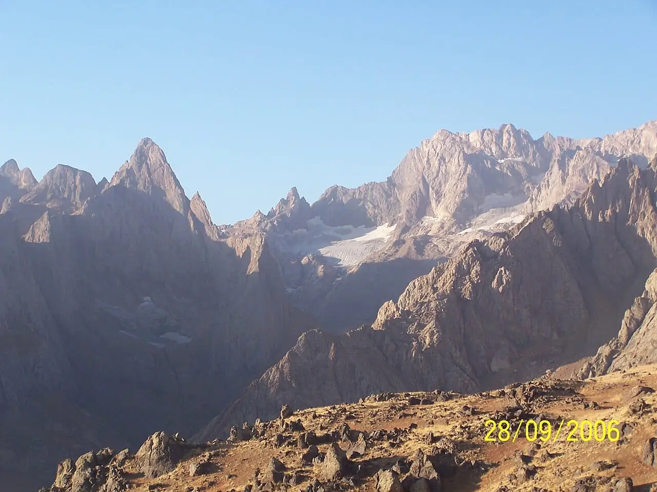 Photo: hamza atılgan (CC BY-SA 3.0) · Source
 8 places to visit in the Yüksekova district of Hakkari: Ters Laleler (Ters tulips), Mount Cilo and Reşko Peak and Sat Lakes. Plan your trip to Yüksekova with local food, practical tips and transport information.
Yüksekova is the largest district of Hakkâri province. It lies at the south-eastern tip of the country, close to the point where the borders of Türkiye, Iran and Iraq meet. With an area of 2,547 km² and a population of 121,314, the district lies at an altitude of 1,954 metres. The Esendere border gate is located in the district and opens to Iran.
Settlement in Yüksekova is known with certainty to date back to around 7000 BC. Around 1000 BC the region was home to the Urartians; in the reign of Suleiman I it came under Ottoman rule. In the 19th century it remained a town (kaza) of Hakkâri Sanjak attached to the Van Province, and in 1936 it was given district status. During the First World War it was occupied by Russia, and it was liberated from this occupation on 5 May 1918. In the 1990s it experienced a heavy wave of migration.
The district was established in a depression between mountains. The plain lies at an altitude of about 2,000 metres, and is 15 km wide and 40 km long. As an enclosed basin, the plain has harsh winters, as cold air currents settle over it in winter. The district has a harsh continental climate.
Settlement in Yüksekova is known with certainty to date back to around 7000 BC. Yüksekova was given district status in 1936. The remains of Büyükçiftlik are believed to be those of Musaşir, an important Urartian city. The Ordu Road from the Urartian period runs from the Yüksekova Kelişin Pass to Van.
Last updated:
The Kelaşin and Topuzava stelae on the Ordu Road, which belongs to the Urartian civilisation, bear inscriptions written in the Urartian language.
View on mapWest of Yüksekova, at the mouth of the Aviş stream, lie the remains of a large city and castle.
View on mapIn the Derav Valley, near Gagevran village, there are churches carved into the rocks in the 11th century.
View on mapOne of the district's famous flowers, which blooms in spring and represents the natural beauty of the town.
View on map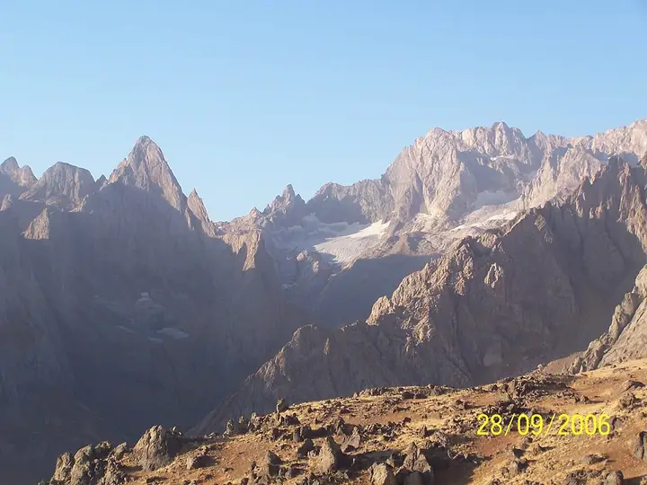 Photo: hamza atılgan (CC BY-SA 3.0) · Source
 Reşko (Uludoruk/Gelyaşin), Türkiye's second-highest peak, at 4,135 metres, lies in the Cilo Mountains. It is a world-renowned destination for mountaineering, trekking and winter sports.
View on mapGlacial lakes at the foot of the Cilo Mountains, with clear waters and high mountain views around them, are among the most striking natural beauties of Türkiye. The area is suitable for camping and nature photography.
View on mapDeclared Türkiye's 45th national park on 26 September 2020, the Cilo-Sat Mountains National Park is a unique nature conservation area with glacial lakes, waterfalls and endemic plant species.
View on mapThe Yüksekova Plain lies at an altitude of 1,800 metres above sea level. It is a wide flatland surrounded by high mountains. The plain is covered with snow in the winter months and turns green in the summer.
View on mapWhile you are in Yüksekova, you can also see the highlights of Hakkari province. These places are in other districts; Yüksekova is about 80 km from the provincial centre.
Yüksekova Çirek Cheese was registered as a protected geographical indication on 18 April 2022 (TÜRKPATENT registration no. 1086). Product group: cheeses. Registered by: Yüksekova Chamber of Commerce and Industry.
A regional kebab made by preparing lamb with special spices and cooking it over charcoal. It is the traditional dish of Yüksekova.
Made from fresh milk and separated into strands, çeçil cheese is Yüksekova's best-known dairy product.
Traditional bread baked in a clay tandır oven, a basic staple of Yüksekova's daily cuisine.
Located at the foot of the Cilo Mountains, Yüksekova is one of Türkiye's most important mountaineering centres. The annual Cilo Mountain Festival hosts mountaineering and outdoor sports events.
For centuries the people of Yüksekova have migrated to the plateaus in the summer months. Traditional plateau houses, livestock farming and dairy production are living examples of this culture.
Yüksekova is the most populous district of Hakkari. Livestock farming, border trade and small-scale commerce are the main economic activities. Mountain tourism potential is developing thanks to the Cilo-Sat Mountains National Park.
Yüksekova is 80 km from Hakkari city centre. Yüksekova Selahaddin Eyyubi Airport lies within the district boundaries. There are air connections to Istanbul and Ankara. Van is about 280 km away.
The 8 highlights of Yüksekova are Ters Laleler, Mount Cilo and Reşko Peak, Sat Lakes, Cilo-Sat Mountains National Park, Yüksekova Plain, Büyükçiftlik (Hırvata) city and castle ruins, Derav Valley, rock-cut churches near Gagevran village, and the Ordu Yolu: Kelaşin and Topuzava stelae.
Yüksekova Çirek Cheese, Yüksekova Kebabı, Çeçil Peyniri and Tandır Ekmeği are the standout dishes at Yüksekova's tables.
Yüksekova is known for its Yüksekova Honey and its Mountaineering Culture. Yüksekova honey, obtained from endemic flowers in the Cilo Mountains, is known for its organic character and rich aroma.
Yüksekova is 80 km from Hakkari city centre. Yüksekova Selahaddin Eyyubi Airport lies within the district boundaries. There are air connections to Istanbul and Ankara. Van is about 280 km away.
Suggested visit length: 2-3 days. Best time to visit: summer months (June-September).