 Photo: mehmetkursun (CC BY-SA 3.0) · Source
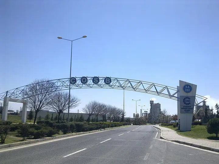
 Çerkezköy Organized Industrial Zone
Established in 1973 in the town of Kapaklı, this major industrial zone employs more than 60,000 people.
View on map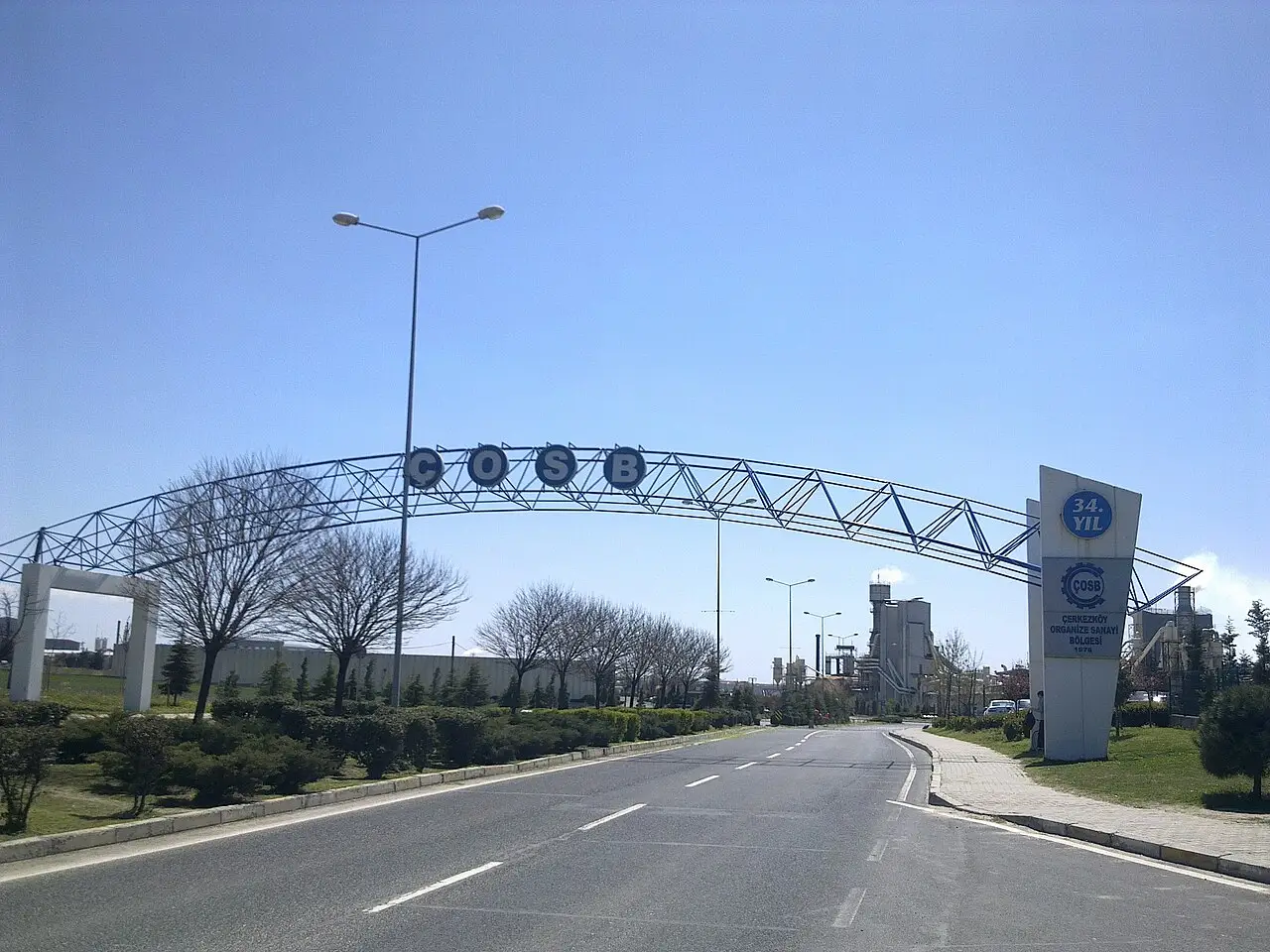 Photo: mehmetkursun (CC BY-SA 3.0) · Source
 4 places to visit in the Çerkezköy district of Tekirdağ: Çerkezköy Organized Industrial Zone, Çerkezköy Parks and Ergene Basin. Plan your trip to Çerkezköy with local food, practical tips and transport information.
Çerkezköy is a district of Tekirdağ Province, continuously developing as a commercial and industrial town. After Istanbul and its neighbour Çorlu, it is the third-largest settlement in Turkish Thrace. The district covers 86 km², stands at an altitude of 145 m and has a population of 223,975.
Opinions differ on whether the first village founded in the Çerkezköy area was Çerkezköy or Türbedere. Because of the türbe (tomb) in the garden of Atatürk Primary School, the area of the stream bed was named Türbedere. Documents concerning the estimated cost of a construction planned at Türbedere in the Çerkes village are held in the Prime Ministry Ottoman Archives. Studies carried out after the Ottoman-Russian War indicate that 3 intertwined villages existed in this area: Çerkezköy, Türbedere and Yeniköy. Çerkezköy was occupied by Bulgaria between 26 October 1912 and 30 June 1913, and by Greece between 23 July 1920 and 30 October 1922. On 1 April 1958, Çerkezköy was made a district.
Until the 1970s a small rural settlement, the district entered a period of development when a 1971 Council of Ministers decision placed it among the priority areas for development and a 1973 decision led to the establishment of the Organized Industrial Zone, starting a rapid process of industrialisation. Large private sector firms using modern technology and producing mainly for export have concentrated in weaving, metal goods and machinery manufacturing. The industrial facilities in the area employ more than 60,000 workers and contribute to the Turkish economy.
According to 2011 TÜİK (Turkish Statistical Institute) data, of the 177,442 residents of Çerkezköy, 92,301 are men and 85,141 are women. The higher proportion of men in the district is due to the greater number of men who come to work in the factories. The population of Kapaklı town, where the Organized Industrial Zone (OSB), which employs 60,000 people, is located, had reached 65,000 by 2012.
Çerkezköy district is part of Tekirdağ Province and lies at 41 degrees 17 minutes 06 seconds north latitude and 28 degrees 00 minutes 01 second east longitude. The average elevation of Çerkezköy town centre above sea level is 190 metres. Çerkezköy is bordered by Istanbul to the east, by Çorlu to the south and west, and by the Saray districts to the north. Tekirdağ, the provincial centre, is 56 km away, and Istanbul is 110 km away.
Çerkezköy district is strongly influenced by the Thracian climate. Cold northerly winds that blow in the area from time to time bring temperature drops. Temperatures range from 25 °C to 35 °C in summer and from 10 °C to −8 °C in winter.
Çerkezköy was founded by Circassian migrants from the Caucasus after the Ottoman-Russian War. Çerkezköy officially gained district status on 1 April 1958.
In 1911 Çerkezköy became a nahiye (subdistrict) and a municipality. Its first mayor was Molla Mehmet Efendi. Çerkezköy was occupied by Greece between 23 July 1920 and 30 October 1922.
Occupied by Greece between 23 July 1920 and 30 October 1922. Marmara Ereğlisi was liberated from enemy occupation on 29 October, Çerkezköy and Saray districts on 30 October, Çorlu on 1 November, Muratlı on 2 November, Malkara and Hayrabolu on 14 November, and Şarköy on 17 November, and they returned to Turkish administration.
Last updated:
Photo: mehmetkursun (CC BY-SA 3.0) · Source Established in 1973 in the town of Kapaklı, this major industrial zone employs more than 60,000 people.
View on mapModern parks in the town centre, with walking trails and sports facilities, are places for families to relax. This structure, an important cultural heritage for the people of Çerkezköy, bears witness to the history of the district.
View on mapA natural region of gently undulating plains surrounding Çerkezköy. The waters of the Ergene River and the Çorlu Stream gather in this basin.
View on mapThe city park in Çerkezköy has a total area of 53,000 square metres, made up of a first phase of 15,000 square metres and a second phase of 38,000 square metres. The park has a basketball court, tennis court, running and cycling paths, children's play areas and a skate track.
View on mapWhile you are in Çerkezköy, you can also see the highlights of Tekirdağ province. These places are in other districts.
Tekirdağ köftesi is also served in Çerkezköy using the traditional recipe. An important dish on local family tables, it is prepared using traditional recipes.
Prepared by frying fresh veal liver in thin slices. Made using recipes passed down from generation to generation, this dish is an important part of the region's culinary culture.
Çerkezköy is one of the major industrial centres of Thrace. This tradition is passed down from generation to generation as an important element of the local people's cultural identity.
Çerkezköy's economy is based on industry. Textiles, food and chemicals are the main economic activities.
Çerkezköy is 90 km from Istanbul. The TEM motorway runs through the district.
The 4 standout places in Çerkezköy: Çerkezköy Organized Industrial Zone, Çerkezköy Parks, Ergene Basin and Çerkezköy City Park.
Tekirdağ Köftesi and Trakya Ciğeri are standout dishes on tables in Çerkezköy.
Çerkezköy is known for Sunflowers and Industrial Culture. Sunflowers are grown around Çerkezköy.
Çerkezköy is 90 km from Istanbul. The TEM motorway runs through the district.
Recommended visit length: half a day. Best time to visit: spring and autumn.