6 places to visit in the Taşlıçay district of Ağrı: Taşlıçay Plain, Taşlıçay Creek Valley and South-western Slopes of Mount Ararat (Ağrı Dağı). Plan your trip to Taşlıçay with local food, practical tips and transport information.

Share with friends

The district covers 822 km² and sits at an elevation of 1,761 metres.

History

The settlement, which had previously been a bucak attached to the district of Diyadin, was made a district in 1954, with its centre at Aşağıtaşlıçay.

Geography

The district lies on the Türkiye-Iran transit route, on the northern bank of the Murat River. Diyadin and Doğubayazıt lie to the east, and the districts of Ağrı and Eleşkirt lie to the west. The district has a continental climate: summers are hot and dry, and winters are cold and snowy.

History and Culture

Taşlıçay was a bucak attached to Diyadin until 1954, when it became a district. Shia Azeris and Shafi’i Kurds live in the district. The district was founded on the northern bank of the Murat River, on the Iranian transit route.

Last updated:

Places to Visit in Taşlıçay

  • 1 Historic
  • 5 Nature
Nature

Taşlıçay Plain

Stretching along the south-western foothills of Ağrı Mountain, the Taşlıçay Plain is one of Türkiye's highest plains, at an elevation of 2,000 metres. Its green meadows and flower cover in the summer months offer beautiful frames for nature photographers.

View on map
Nature

Taşlıçay Creek Valley

This valley, which extends along the Taşlıçay Creek that gives the district its name, is a suitable route for nature walks thanks to its rocky structure and clear waters. The green areas along the creek are preferred for picnics.

View on map
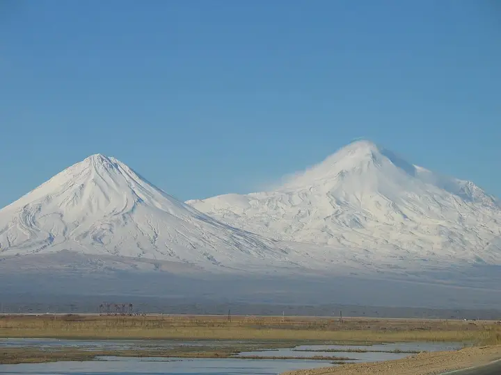
South-western Slopes of Mount Ararat (Ağrı Dağı) - Taşlıçay Photo: Cemil1280 (FAL) · Source
Nature

South-western Slopes of Mount Ararat (Ağrı Dağı)

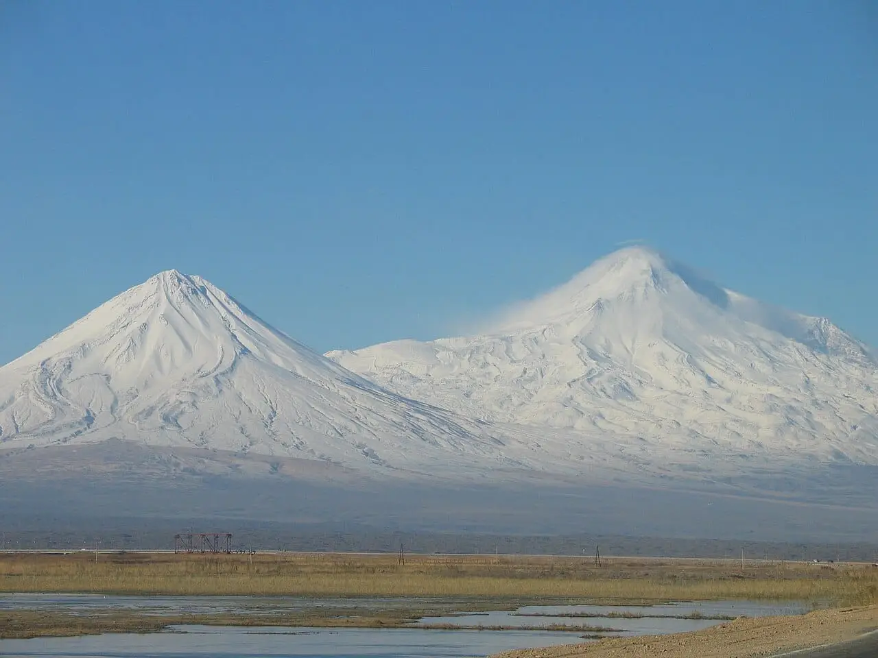
Taşlıçay is the district closest to the south-western slopes of Ağrı Mountain. From these slopes there are impressive viewpoints from which both Büyük and Küçük Ağrı can be seen together.

View on map
Historic

Taşlıçay Castle

The remains of this castle on a rocky hill near the district bear witness to the history of the region. It is thought to have been used for border defence in the Ottoman period.

View on map
Nature

Mount Muratbaşı (Koçbaşı)

The highest point of the district; a mountain located on Aladağ to the south.

View on map
Nature

Balık Lake

A high-altitude lava-dammed lake on the border of Taşlıçay and Doğubayazıt.

View on map

Places to Visit Around Ağrı Province

See all →

While you are in Taşlıçay, you can also see the highlights of Ağrı province. These places are in other districts.

  • İshak Paşa Palace — The palace in Doğubayazıt was begun in 1685 by Çolak Abdi Paşa of the Çıldır Atabeys and completed in 1784, after 99 years, in the time of Küçük İshak Paşa.
  • Mount Ağrı — At 5,137 metres, the highest mountain in Türkiye; it is 16 km from Iran and 32 km from Armenia, and about 35 per cent of it lies within Ağrı province.
  • Mount Ağrı National Park — A national park of 88,014 hectares declared in 2004; it covers Mount Ağrı (5,137 m) and Little Ağrı (3,898 m), the largest glacier in Türkiye, a meteor crater and the ice cave on Little Ağrı.
  • Old Bayazıt Castle and Ruins — The castle at Upper Bayazıt (Yukarı Bayazıt), where Doğubayazıt was first founded, and Urartian tombs lie around it.
  • Ahmed-i Hânî Tomb — The tomb of Ahmed-i Hânî, poet and scholar and author of the mesnevi Mem û Zîn, stands close to İshak Paşa Palace and is a popular stop for visitors.
  • Durupınar Formation (Noah's Ark) — A ship-shaped limonite formation 164 metres long, at 1,966–2,004 metres, 16 km south-east of Doğubayazıt near the village of Üzengili.

Practical Information for Visiting Taşlıçay

Suggested time
1 day
Best time to visit
June–September
Places to visit
6 places

What to Eat in Taşlıçay

Food guide →
  • Abdigör Köftesi (boiled beef meatballs)

    The signature flavour of the Ağrı region, Abdigör köftesi is also among the most loved dishes in Taşlıçay. It is prepared by kneading lean minced beef with special spices and then boiling it.

  • Kesme Aşı (hand-cut noodle soup)

    Made with hand-cut noodles, lentils and yoghurt, this soup is the favourite dish of Taşlıçay's cold winter days.

  • Tandır Ekmeği (clay oven bread)

    Baked in a clay tandoor oven, this traditional bread is an indispensable part of Taşlıçay's village tables. It is eaten with fresh butter and honey.

  • Kavut (roasted wheat dessert)

    Kavut, made by mixing roasted wheat flour with butter and sugar, is one of Taşlıçay's traditional desserts.

Culture, Local Products and Economy of Taşlıçay

  • Plateau Migration Tradition

    The tradition of migrating to the plateaus in the summer months is still maintained in the mountain villages of Taşlıçay. This seasonal migration is an important part of the cultural identity of the region.

  • Legends of Mount Ararat

    Taşlıçay is one of the settlements closest to Ağrı Mountain, and it is a region where legends and stories about the mountain are kept alive.

  • Handicrafts

    Kilim weaving and wool craftsmanship are maintained in Taşlıçay as traditional handicrafts.

Local Products

  • Honey — Flower honey collected on the high plateaus of Taşlıçay is the most valuable natural product of the region.
  • Dairy Products — In Taşlıçay, where livestock farming is the main livelihood, cheese, yoghurt and butter are produced by traditional methods.
  • Wool — Wool production is an important local production line in Taşlıçay, where sheep farming is widespread.

Economy

The economy of Taşlıçay is largely based on livestock farming. Small and large livestock farming is the district's main livelihood. Because of the high elevation, farming is limited and barley and forage crops are grown. Beekeeping is a developing sector. The migration of young people to large cities is an important factor affecting the district's economy.

How to Get to Taşlıçay

Taşlıçay is 35 km from Ağrı city centre and is reached by road. Located on the Ağrı-Doğubayazıt road, the district has regular minibus services from Ağrı. The nearest airport is Ağrı Ahmed-i Hani Airport (45 km).

Get directions on Google Maps Getting to Ağrı

Taşlıçay: Frequently Asked Questions

What are the places to see in Taşlıçay?

The 6 highlights of Taşlıçay are: Taşlıçay Plain, Taşlıçay Creek Valley, South-western Slopes of Mount Ararat (Ağrı Dağı), Taşlıçay Castle, Mount Muratbaşı (Koçbaşı) and Balık Lake.

What is there to eat in Taşlıçay?

Abdigör Köftesi, Kesme Aşı, Tandır Ekmeği and Kavut are the flavours that stand out at Taşlıçay's tables.

What is Taşlıçay famous for?

Taşlıçay is known for honey and the Plateau Migration Tradition. The flower honey collected on Taşlıçay's high plateaus is the most valuable natural product of the region.

How do I get to Taşlıçay?

Taşlıçay is 35 km from Ağrı city centre and is reached by road. Located on the Ağrı-Doğubayazıt road, the district has regular minibus services from Ağrı. The nearest airport is Ağrı Ahmed-i Hani Airport (45 km).

How much time should I set aside for a visit to Taşlıçay?

Suggested visit length: 1 day. Best time to visit: June–September.

Continue Your Trip

Other Districts of Ağrı

Search 81 province guides and 968 district guides.