Eruh Castle
The castle on the hill above the district centre dates to the Artuqid period. The Eruh Plain and surrounding mountains can be seen from the castle.
View on map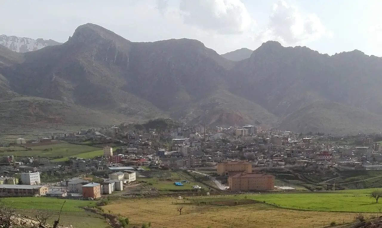 Photo: Zmangeldi (CC BY-SA 4.0) · Source
 9 places to visit in the Eruh district of Siirt: Tarti Mountain, Botan River and Eruh Castle. Plan your trip to Eruh with local food, practical tips and transport information.
Eruh is a district of Siirt province, at an elevation of 1,161 metres. It lies at the intersection of 42° East longitude and 38° North latitude. Şırnak lies to the east, Siirt to the west, Pervari to the north and Güçlükonak to the south.
The founding date of Eruh is not precisely known, but from around 1000 BC it was under the rule of the Urartian, Median, Persian, Seljuk and Ottoman empires. During the reign of Yavuz Sultan Selim, the region was added to Ottoman territory, and historical records confirm that Eruh is one of the oldest districts of Siirt. The 1899 Bitlis Salnamesi (provincial yearbook) records that Eruh was a district (kaza) attached to the Siirt Sanjak, with three sub-districts named Dergül, Lodi and Fındık.
Eruh, which lies midway along the 98 km main road connecting Siirt and Şırnak provinces, sits within a range of mountains. Most of its land is covered with mountains, and the terrain is undulating and rugged; the district has ranges that extend from the South-eastern Taurus Mountains. The highest mountains in the district are Tarti Mountain (Terazin), at 2,265 metres, and Tünek (Avâl) Mountain, at 2,100 metres. The Terazin and Çirav plateaus on Tarti Mountain and the Gerî and Qısa Çeşme plateaus in the Cevizlik valley are of great importance for livestock farming. The Zorava Stream begins near Kuşdalı village and joins the Botan River, while the Şikefta Stream joins the Zorava Stream near the Mergi hamlet in Şirvan.
As Eruh lies in both the Eastern Anatolia and Southeastern Anatolia regions, the district has the climate of both, generally a continental climate. Winters are harsh and rainy, and summers are hot and dry. The average annual temperature is 14 to 31 degrees, and annual rainfall is 67,401 m3.
Eruh is recorded in historical sources as one of the oldest districts of Siirt. With the founding of the Republic, Eruh became a district attached to Siirt. It is noted that some villages bear the name Garisi and are related to the Sindi tribe in Northern Iraq.
Last updated:
The castle on the hill above the district centre dates to the Artuqid period. The Eruh Plain and surrounding mountains can be seen from the castle.
View on mapTraditional houses built in local stone architecture can be found in the villages of Eruh. They have thick stone walls and flat roofs, suited to the climate of the region.
View on mapOne of the highest mountains, at 2,265 metres, with the Terazin and Çirav plateaus.
View on mapAn important river flowing through the west of Eruh, into which the Zorava and Şikefta streams and other streams flow.
View on mapDeep valleys surrounding the district, with rocky slopes and natural vegetation, stand out.
View on mapThe valley formed by the Botan Stream, a national park that also lies within the borders of Eruh.
View on mapImportant plateaus for livestock farming in the Cevizlik valley.
View on mapA stream rising from a spring near Kuşdalı village and flowing into the Botan River.
View on mapWhile you are in Eruh, you can also see the highlights of Siirt province. These places are in other districts; Eruh is about 70 km from the provincial centre.
Büryan kebab, made by slow-cooking lamb in a tandır oven, is served in Eruh in its traditional recipe.
A traditional soup made with lentils, bulgur and yoghurt, the staple dish of Eruh's winter months.
Eruh is a district that keeps up a traditional rural way of life. A lifestyle focused on livestock farming and agriculture continues.
The economy of Eruh is based on livestock farming and agriculture. Small livestock farming is the main source of livelihood. Wheat and barley are grown.
Eruh is 70 km from Siirt city centre. The district is reached by road via Siirt. It is 80 km from Şırnak.
The 9 highlights of Eruh are Tarti Mountain, Botan River, Eruh Castle, Eruh Valleys, Historic Stone Houses, Botan Valley National Park, Tarti (Terazin) Mountain, Gerî and Qısa Çeşme plateaus and Zorava Stream.
Büryan Kebabı and Keledoş are the standout flavours on Eruh's tables.
Eruh is known for Honey and its Rural Way of Life Tradition. Flower honey gathered from the mountainous areas of Eruh is known for its natural and aromatic character.
Eruh is 70 km from Siirt city centre. The district is reached by road via Siirt. It is 80 km from Şırnak.
Suggested visit length: half a day. Best time to visit: spring and autumn.