 Photo: Zeynel Cebeci (CC BY-SA 4.0) · Source
 Suşehri Dam
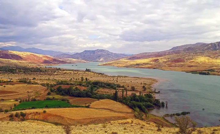
A dam built on the Kelkit River, offering fishing and boat trips on its wide lake.
View on map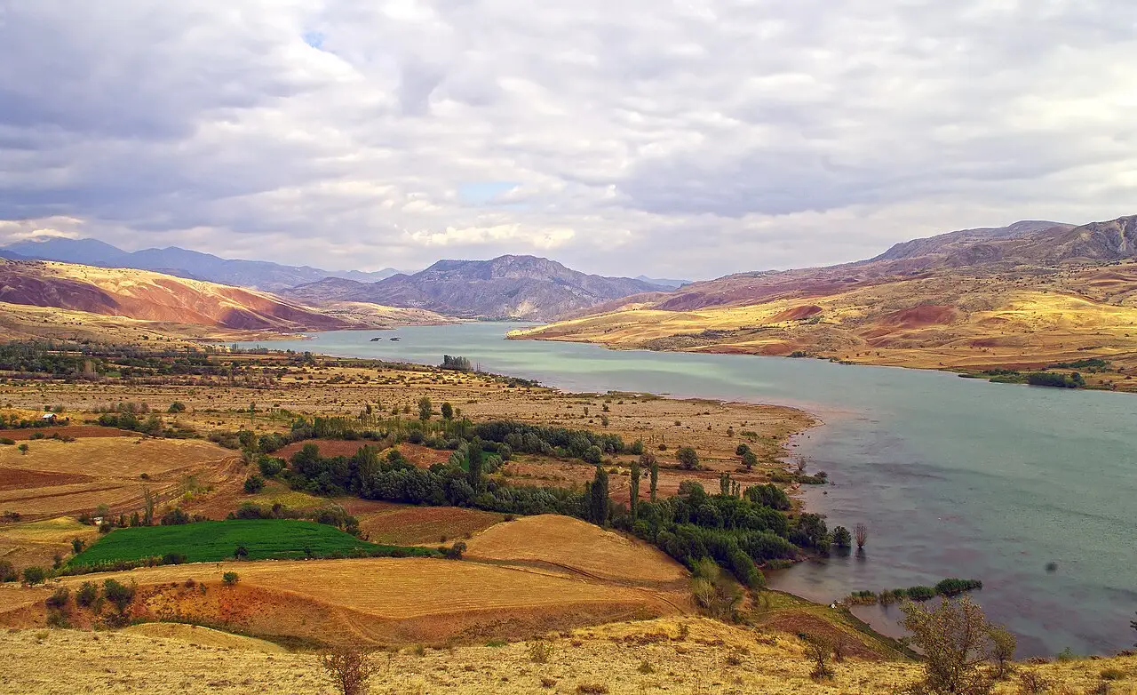 Photo: Zeynel Cebeci (CC BY-SA 4.0) · Source
 6 places to visit in the Suşehri district of Sivas: Suşehri Dam, Kelkit River Valley and Suşehri Plateaus (Yaylaları). Plan your trip to Suşehri with local food, practical tips and transport information.
Suşehri, formerly known as Enderes or Endires, is a district of Sivas in the south-west of the Eastern Black Sea section of the Black Sea Region. According to 2025 population statistics, Suşehri has a total population of 25,056 and is the third most populous district of Sivas after Şarkışla and Yıldızeli. The district covers 939 km² and has an average altitude of 1,077 m.
The district, whose name in the earliest periods was Nikopolis, is later recorded as Andriyas or Andıras. The original of this name is Adra in the Luwian language, meaning “male”, “husband” and “consort of the mother goddess”.
Suşehri’s history goes back to the Chalcolithic Age, and objects showing Chalcolithic characteristics were found in archaeological excavations near Kayadelen village. On 3 July 1243, the Battle of Kösedağ between the Anatolian Seljuk State and the Mongols took place in the district of Suşehri, ending with the defeat of the Seljuk State and its submission to the Mongols. In the provincial reorganisation of 1875, Şebinkarahisar, to which Suşehri belonged, was attached to Sivas Province. By a law passed on 20 May 1933, Şebinkarahisar, to which Suşehri belonged, was made a district, and Suşehri was attached to Sivas province.
Suşehri lies in the north-east of Sivas, bordered by Akıncılar to the east, İmranlı to the south, Zara to the south-west, Koyulhisar to the west and the Giresun districts of Şebinkarahisar to the north. The district lies on the section of the North Anatolian Fault Line, about 155 km long, between Erzincan and Koyulhisar. On 18 May 1929, a magnitude 6.1 earthquake in Suşehri killed 64 people, injured more than 72, and destroyed or heavily damaged hundreds of houses.
One of the most important factors shaping the culture is the geographical location; because the district lies in the Black Sea Region, Suşehri has Kemençe, Zurna and Horon culture.
Suşehri’s history goes back to the Chalcolithic Age, and objects showing Chalcolithic characteristics have been found in archaeological excavations in the area. The district’s old name was Enderes or Endires, and it is thought that the name Suşehri came into use because of the abundance of water sources nearby. Because it lies in the Black Sea Region, Suşehri has Kemençe, Zurna and Horon culture rather than the folk dances specific to Sivas. In 1875 the Şebinkarahisar sanjak was taken from Trabzon Province and attached to Sivas Province. The region’s livelihood is agriculture and livestock farming; because of its rich soil, almost every kind of vegetable and fruit can be grown.
Last updated:
Photo: Zeynel Cebeci (CC BY-SA 4.0) · Source A dam built on the Kelkit River, offering fishing and boat trips on its wide lake.
View on mapThe valley stretching along the Kelkit River that flows through Suşehri is notable for its natural beauty.
View on mapThe highland pastures in the upper parts of the district are preferred in summer for their cool air and natural beauty. The footpaths leading up to the plateaus offer routes of different difficulty for trekking enthusiasts.
View on mapAn artificial lake set up east of Suşehri. Excavations carried out near Kayadelen village, under the dam waters, have revealed objects showing Chalcolithic characteristics.
View on mapAkşar village, one of the villages attached to Suşehri, was an important centre in the Middle Ages. In the Seljuk period it is known as an important transport point under the name Aq-Šahr.
View on mapA museum exhibiting archaeological finds from Suşehri district and the historical works of the Sivas region. Its collection includes a lion-head marble found in Küçükgüzel village.
View on mapWhile you are in Suşehri, you can also see the highlights of Sivas province. These places are in other districts; Suşehri is about 140 km from the provincial centre.
Sivas köfte, made with minced meat and spices, is also served in Suşehri using the traditional recipe.
Keşkek, prepared by cooking wheat and meat for a long time and pounding them, is indispensable at wedding tables. Small differences in each village's keşkek recipe add to the richness of the dish.
Suşehri is a district that maintains a traditional rural way of life. This tradition is passed from generation to generation as an important element of the local people's cultural identity.
Suşehri's economy is based on agriculture, livestock farming and trade. Wheat and barley are the main agricultural products. The district is a trade centre for the surrounding districts.
Suşehri is 140 km from Sivas provincial centre and 120 km from Erzincan. It is reached by road.
6 prominent places in Suşehri: Suşehri Dam, Kelkit River Valley, Suşehri Plateaus, Kılıçkaya Dam, Akşar Village and Sivas Museum.
Sivas Köftesi and Keşkek are the standout flavours on Suşehri's tables.
Suşehri is known for Suşehri Dry Beans and its Rural Life Tradition. It is a product registered with TÜRKPATENT as a protected geographical indication.
Suşehri is 140 km from Sivas provincial centre and 120 km from Erzincan. It is reached by road.
Suggested visit length: half a day. Best time to visit: spring and summer.