Oltu Russian Church
Church built by the Russians between 1885 and 1890, east of the district centre of Oltu.
View on map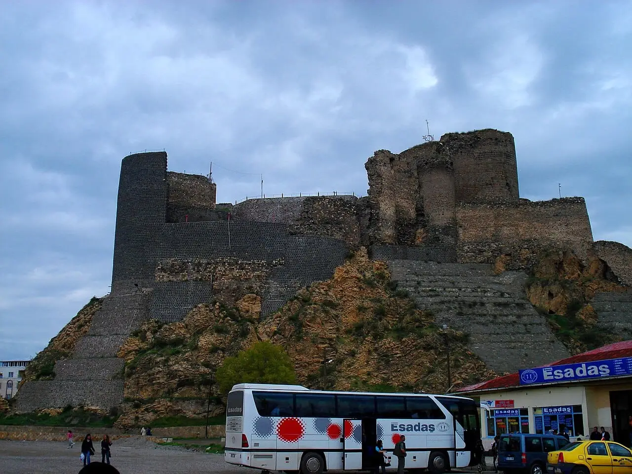 Photo: MaxBenidze (CC BY-SA 4.0) · Source
 8 places to visit in the Oltu district of Erzurum: Oltu Castle, Oltu Taşı Mines and Gökkaya (Rainbow) Hills. Plan your trip to Oltu with local food, practical tips and transport information.
Oltu lies in the north-east of Erzurum province, at the meeting point of the Eastern Anatolia and Eastern Black Sea regions. The district covers 1,441 km², and its elevation above sea level is 1,271 metres. Located 117 km from Erzurum provincial centre, Oltu ranks first in socio-economic development after the central districts of Erzurum.
The history of Oltu goes back to before the 10th century BC. The region came under the rule of the Hurrians, Urartians, Cimmerians, Scythians, Persians, Macedonians, Parthians and many other states. An inscription found at Oltu Castle is dated to the 7th century AD. The city castle once belonged to the Mamikonian naxarars and later passed to the Bagratunis.
The district centre of Oltu is built in the valley of the Oltu Stream, a tributary of the Çoruh River. Beyond the valley lie extensive mountain forests. The district’s forests include trees such as poplar, Scots pine, fir and hornbeam.
Oltu is famous for Oltu stone, a semi-precious stone. Also known as black amber, Oltu stone is brilliant black in colour and becomes harder and shinier the more it is worked. It is used to make jewellery, prayer beads, keyrings and boxes and other ornamental items.
After the Armistice of Mudros, Oltu remained under the Oltu Soviet Government for 13 months and joined Ankara in 1920. Restoration of the Russian Church of Oltu, begun in 2019, was completed in 2023. Oltu Castle has been repaired many times; most recently it was restored in 1998–1999.
Last updated:
Church built by the Russians between 1885 and 1890, east of the district centre of Oltu.
View on mapIn Gaziler village, a Saltukid castle from the 12th century and a small mosque dated 1784.
View on map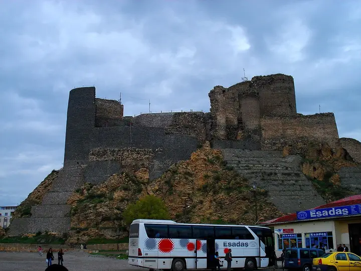 Photo: MaxBenidze (CC BY-SA 4.0) · Source
 A medieval castle built on a rocky outcrop, the result of two major phases of construction between the 7th and 11th centuries.
View on mapGrand Mosque in the district centre, built in the Ottoman period and notable for its stonework and wooden minbar. It is one of the most important religious buildings in the region.
View on mapA domed mosque with a pencil minaret, built by Arslan Paşa in 1665 together with his tomb.
View on mapThe coloured hills around Oltu, made of red sandstone containing iron minerals, attract nature photographers. The vivid colours that appear after rain have given the area its name, the 'rainbow hills'.
View on mapOltu taşı (jet), a black semi-precious stone unique to Oltu, is mined only in this region in the world. It is an organic mineral used to make prayer beads, necklaces and rings. The stone workshops are open to visitors.
View on mapWhile you are in Oltu, you can also see the highlights of Erzurum province. These places are in other districts; Oltu is about 125 km from the provincial centre.
Oltu Cağ Kebabı was registered as a protected geographical indication on 22 February 2010 (TÜRKPATENT registration no. 127). Product group: dishes and soups. Registered by: Oltu Chamber of Commerce and Industry.
Oltu Taşı was registered as a protected geographical indication on 27 November 2015 (TÜRKPATENT registration no. 192). Product group: other products. Registered by: Oltu Chamber of Commerce and Industry.
Oltu's famous dish, the cağ kebabı most closely associated with the district.
Oltu stone craftsmanship is a traditional craft that has continued for centuries. Craftsmen cut the stone from the mine and shape it with hand tools to make prayer beads, jewellery and ornaments. This craft is an inseparable part of the district's cultural identity.
Oltu was an important settlement centre in the Urartian, Roman, Byzantine, Seljuk and Ottoman periods. The district, under Russian control for a short time until 1918, joined Türkiye after the War of Independence.
The economy of Oltu rests on livestock farming, agriculture and Oltu stone mining. Oltu stone craftsmanship is an important source of income and employment. Wheat, barley and fodder crops are grown. Small livestock farming is also widespread.
Oltu is about 125 km from Erzurum city centre. Access is by the Erzurum–Artvin road. The nearest airport is Erzurum Airport. The district can be reached by intercity bus and minibus services.
The eight highlights of Oltu are Oltu Castle, Oltu Taşı Mines, Gökkaya (Rainbow) Hills, Oltu Grand Mosque, Oltu Russian Church, Arslan Paşa Mosque, Mısri Zennun Tomb (kümbet) and Saltukid Castle in Gaziler village.
Oltu Cağ Kebabı, Oltu Taşı and Cağ kebabı are the standout flavours on Oltu's tables.
Oltu is known for Oltu Taşı and the Oltu Stone Craftsmanship Tradition. The black semi-precious stone mined only in the Oltu district of Erzurum is an organic mineral used to make prayer beads, necklaces, rings and bracelets, and it is a registered geographical indication.
Oltu is about 125 km from Erzurum city centre. Access is by the Erzurum–Artvin road. The nearest airport is Erzurum Airport. The district can be reached by intercity bus and minibus services.
Suggested visit length: 1 day. Best time to visit: spring and summer months (May–September).