8 places to visit in the İvrindi district of Balıkesir: Mount Kaz, Mount Madra and İvrindi Castle. Plan your trip to İvrindi with local food, practical tips and transport information.

Share with friends

İvrindi is a district of Balıkesir Province, famous for its kelle cheese and lor.

Geography

The district’s land is generally mountainous, with Kaz Mountain to the west and Madra Mountain to the south-west. The district covers 818 km² and has an average elevation of 276 metres above sea level.

History

İvrindi’s history of settlement goes back to 3000–4000 BC. After Balıkesir and its surroundings were conquered by Kutalmışoğlu Süleyman Şah in 1076, Turkish rule began. In the early years of the Republic, İvrindi, then a town (belde), became a district on 2 August 1944.

Economy

The economy is based on farming, and the main crops are wheat, barley, maize and pulses. The kelle sheep’s cheese and höşmerim produced in the district are very well known.

History and Culture

İvrindi, then a town (belde), became a district by Law no. 4642 on 2 August 1944. A festival called Panayır (fair) is held in İvrindi every year. The Greek occupation forces left the district on 7 September 1922. The history section also names Mysia as the region in which the district lies; this region remained under the Kingdom of Pergamon for a long time.
Last updated:

Places to Visit in İvrindi

  • 1 Historic
  • 1 Ancient City
  • 1 Religious
  • 5 Nature

Historic Sites 1

Historic

İvrindi Castle

The castle remains on the hill above the town centre date from the Byzantine period. The walls of the castle, which was also used in the Ottoman period, are partly standing, and the panoramic view of the İvrindi plain can be seen from the hill.

View on map

Ancient Cities 1

Ancient City

Pionia Ancient Settlement

An ancient settlement within the district's boundaries, located near Gömeniç (Gümeniç).

View on map

Religious Buildings 1

Religious

İvrindi Çarşı Mosque

Built in the Ottoman period, Çarşı Mosque is the oldest place of worship in the town centre. With its stonework and wooden minbar, it is a simple example of local Ottoman mosque architecture.

View on map

Natural Wonders 5

Nature

Mount Kaz

A mountain to the west of the district.

View on map
Nature

Mount Madra

A mountain to the south-west of the district. Chestnut, walnut and thyme grow here.

View on map
Kozak Plateau - İvrindi Photo: Mr. Vehbi Moğol (CC BY-SA 3.0) · Source
Nature

Kozak Plateau

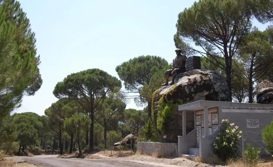
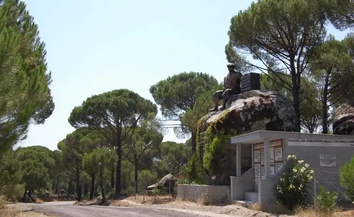
Kozak Plateau, south of İvrindi, is covered with pine forests and stone pine (fıstık çamı) trees. In summer, its cool air and natural beauty make it a popular place for picnics and nature walks.

View on map
Nature

Kocaçay Valley

The Kocaçay valley, which runs west of İvrindi, is a suitable route for nature walks, with its rocky slopes and natural vegetation.

View on map
Nature

Yeşilköy Dam Lake

There is a dam lake in Yeşilköy, and irrigated farming is carried out around it.

View on map

Places to Visit Around Balıkesir Province

See all →

While you are in İvrindi, you can also see the highlights of Balıkesir province. These places are in other districts.

  • Ayvalık Old Town — A coastal town of stone houses, narrow streets, old churches and olive-oil factories, on the UNESCO World Heritage Tentative List since 2017. In antiquity it was known as Kydonia ('wild quince').
  • Cunda (Alibey) Island — The only inhabited island of Ayvalık's 22 islands and the fourth-largest of Türkiye's Aegean islands, it is connected to the mainland by a bridge.
  • Taksiyarhis Church — A metropolitan church built in 1873 on Cunda by the Greek Orthodox community in the name of the archangels Gabriel and Michael; it is the island's most important monument.
  • Şeytan Sofrası (Devil's Table) — A table-shaped hill formed from the lava deposits of an extinct volcano, 8 km south of Ayvalık.
  • Ayvalık Islands Nature Park — A 17,950-hectare nature park established in 1995 and covering 19 islands, where 752 plant species and 671 marine species have been recorded.
  • Zağnos Paşa Mosque — Built in 1461 by Zağnos Paşa, vizier of Mehmed the Conqueror, this is the largest mosque in Balıkesir and the symbol of the city.

Practical Information for Visiting İvrindi

Suggested time
1 day
Best time to visit
Autumn (pine nut harvest) and spring
Places to visit
8 places

What to Eat in İvrindi

Food guide →
  • İvrindi Kelle Peyniri

    İvrindi Kelle Peyniri was registered as a protected geographical indication on 9 February 2022 (TÜRKPATENT registration no. 1025). Product group: cheeses. Registered by: İvrindi Municipality.

  • Keşkek (pounded wheat and meat)

    Keşkek, made by simmering and pounding wheat and lamb for hours, is the traditional dish of wedding and holiday tables in İvrindi.

  • Höşmerim (sweet cheese dessert)

    Höşmerim, made by melting fresh cheese in butter and cooking it with sugar, is İvrindi's traditional dessert.

  • Gözleme

    Thin dough filled with cheese or spinach and cooked on a griddle, gözleme is an indispensable part of the rural breakfast tables of İvrindi.

  • İvrindi kelle koyun peyniri (kelle sheep's cheese)

    Kelle sheep's cheese produced in the district, said to be well known.

Culture, Local Products and Economy of İvrindi

  • Pine Nut Harvesting Tradition

    Each autumn, the pine nut harvest at Kozak Plateau is an economic and social event for the people of İvrindi. The harvest season is celebrated with festivities.

  • Rural Life Culture

    Traditional farming and livestock culture continues in İvrindi's rural neighbourhoods. Village weddings and harvest festivals are living examples of this culture.

Local Products

  • Çam Fıstığı (pine nuts) — Pine nuts collected from the stone pine forests of Kozak Plateau are İvrindi's most valuable local product. Used in pesto sauce and desserts, pine nuts are marketed domestically and internationally.
  • Çam Balı (pine honey) — Pine honey, produced by beekeeping in İvrindi's extensive pine forests, is known for its dark colour and intense aroma.

Economy

İvrindi's economy is based on farming, forestry and livestock. Pine nut production at Kozak Plateau is the district's most important source of income. Beekeeping and pine honey production are also an important sector. Cereals, pulses and olives are grown in agriculture.

How to Get to İvrindi

İvrindi is 45 km from Balıkesir. Transport is by road. There are regular minibus services from the Balıkesir bus terminal. The nearest airport is Balıkesir Koca Seyit Airport (50 km).

Get directions on Google Maps Getting to Balıkesir

İvrindi: Frequently Asked Questions

What are the things to see in İvrindi?

The 8 standout places in İvrindi: Mount Kaz, Mount Madra, İvrindi Castle, İvrindi Çarşı Mosque, Kozak Plateau, Kocaçay Valley, Yeşilköy Dam Lake and Pionia Ancient Settlement.

What is there to eat in İvrindi?

İvrindi Kelle Peyniri, Keşkek, Höşmerim and Gözleme are standout dishes on tables in İvrindi.

What is İvrindi famous for?

İvrindi is known for Çam Fıstığı and the Pine Nut Harvesting Tradition. Pine nuts collected from the stone pine forests of Kozak Plateau are İvrindi's most valuable local product.

How do I get to İvrindi?

İvrindi is 45 km from Balıkesir. Transport is by road. There are regular minibus services from the Balıkesir bus terminal. The nearest airport is Balıkesir Koca Seyit Airport (50 km).

How much time should I set aside for a visit to İvrindi?

Recommended visit length: 1 day. Best time to visit: autumn (pine nut harvest) and spring.

Continue Your Trip

Other Districts of Balıkesir

Search 81 province guides and 968 district guides.