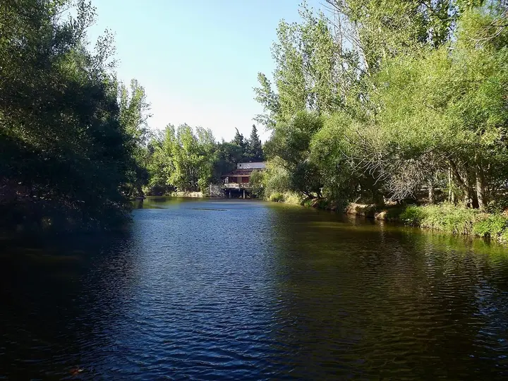
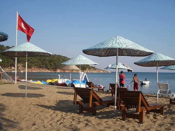
Balıkesir is the only province with coastlines on two seas: the Aegean, with the stone houses of Ayvalık, Cunda Island and the Kaz Mountains, and the Marmara, with Erdek, Kapıdağ and the Marmara and Avşa islands. With the bird sanctuary at Manyas, ancient Kyzikos and Antandros, the Zağnos Paşa Mosque and 46 registered geographical indications (Ayvalık and Edremit olive oil, höşmerim, Susurluk ayran), it makes a rich itinerary.

Share with friends

Last updated:

Places to Visit in Balıkesir

17 places worth seeing in Balıkesir, from historic monuments to natural wonders, grouped by type. Open any of them on the map with a single click.

  • 3 Historic
  • 3 Ancient City
  • 2 Religious
  • 6 Nature
  • 3 Beach

Historic Sites 3

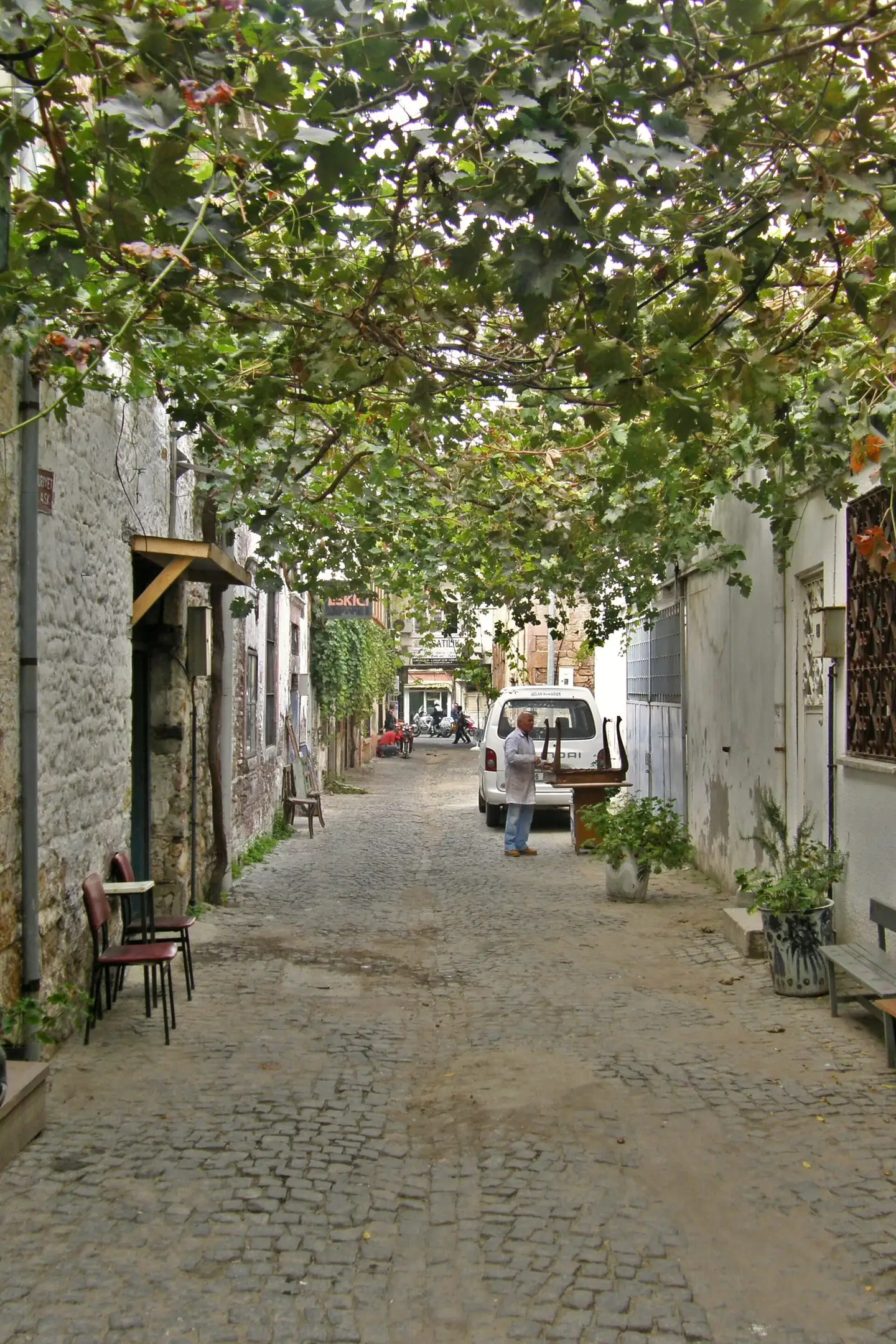
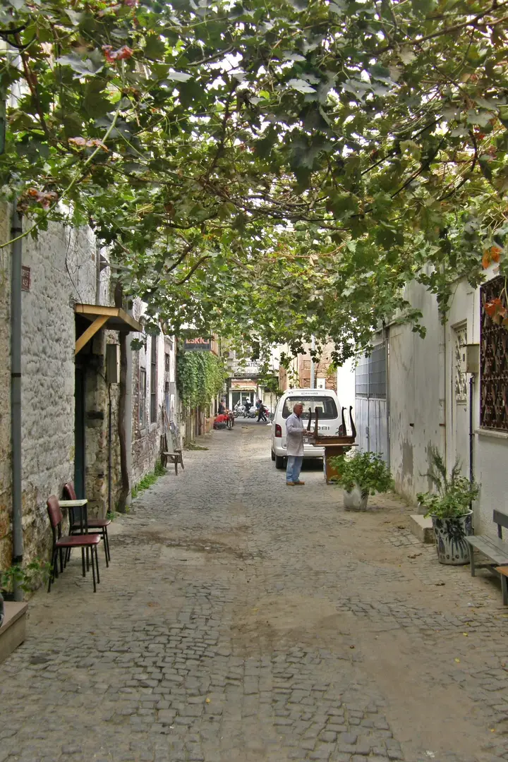
Stone street under a vine trellis in Ayvalık Photo: Bachelot Pierre J-P (CC BY-SA 3.0) · Source
Historic

Ayvalık Old Town

A coastal town of stone houses, narrow streets, old churches and olive-oil factories, on the UNESCO World Heritage Tentative List since 2017. In antiquity it was known as Kydonia ('wild quince').

View on map
Cunda Island harbour Photo: Maurice Flesier (CC BY-SA 4.0) · Source
Historic

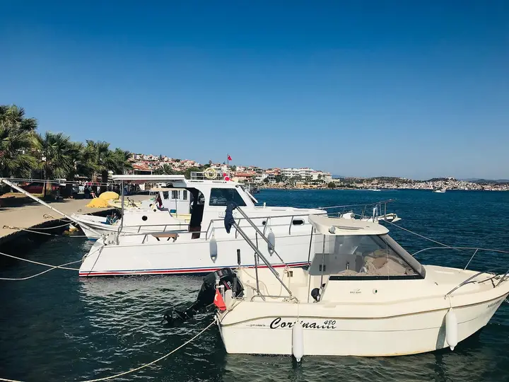
Cunda (Alibey) Island

The only inhabited island of Ayvalık's 22 islands and the fourth-largest of Türkiye's Aegean islands, it is connected to the mainland by a bridge. Its name comes from the Turkish word 'yunt' (wild horse); after 1922 it was renamed Alibey in honour of Ali Çetinkaya, a commander of the Kuvâ-yi Milliye (National Forces).

View on map
Balıkesir Clock Tower Photo: Wikimedia Commons (CC BY-SA) · Source
Historic

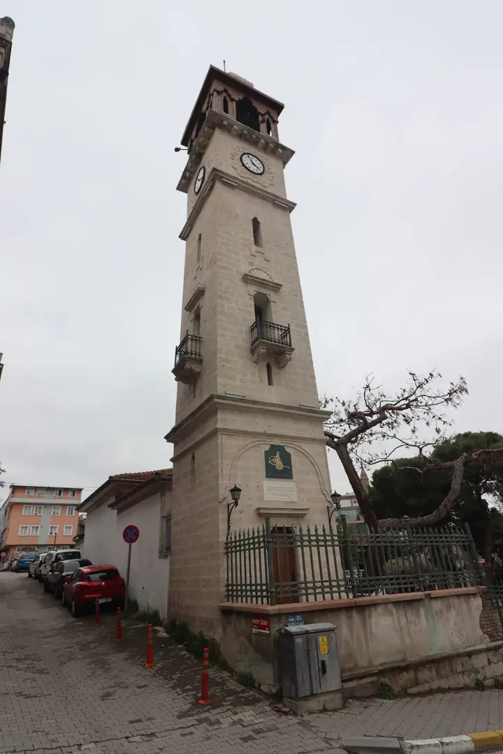
Balıkesir Clock Tower

A 20-metre, five-storey tower built in 1827 by Giritli-zade Mehmet Paşa, governor of Silistra, to the plan of the clock tower at Silistra; it is likened to the Galata Tower. It collapsed in the earthquake of 1897 and was rebuilt faithfully to the original in 1901.

View on map

Ancient Cities 3

Remains of the Temple of Hadrian at Kyzikos Photo: Carole Raddato (CC BY-SA 2.0) · Source
Ancient City

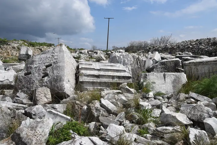
Kyzikos

A Mysian city near Erdek, north of the isthmus joining the Kapıdağ Peninsula to the mainland. With its sheltered harbours it was one of the most powerful cities on the Marmara in antiquity. The huge remains of the Temple of Hadrian, regarded as the 'eighth wonder' of the ancient world, are here; locally the site is known as Belkıs or Balkız.

View on map
Ancient City

Antandros

A Troad city 2 km from Altınoluk that grew rich exporting timber from the Kaz Mountains. According to legend, Aeneas built ships here and set sail after the fall of Troy. Excavations have uncovered a Roman villa decorated with mosaics.

View on map
Ancient City

Adramytteion

An ancient city in the Ören neighbourhood of Burhaniye, believed to have been founded by Adramys, brother of the Lydian king Croesus. The name Edremit comes from this city.

View on map

Religious Buildings 2

Taksiyarhis Church Photo: Osourdounmou (CC BY-SA 4.0) · Source
Religious

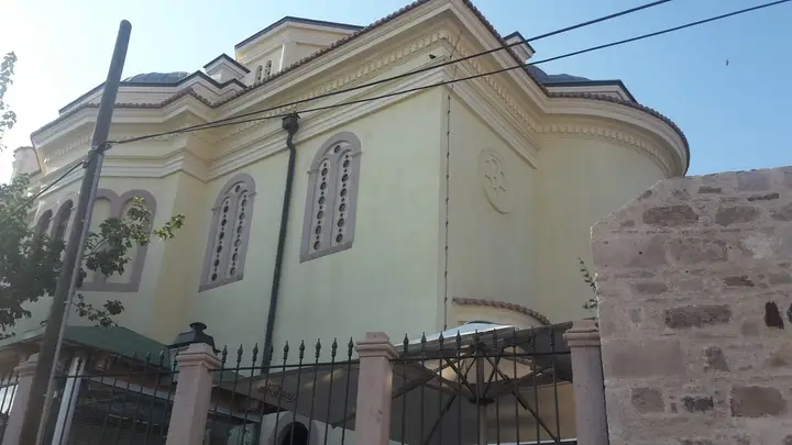
Taksiyarhis Church

A metropolitan church built in 1873 on Cunda by the Greek Orthodox community in the name of the archangels Gabriel and Michael; it is the island's most important monument. In 2011 it was allocated to the Rahmi M. Koç Museum Foundation, restored and opened as a museum.

View on map
Zağnos Paşa Mosque Photo: Wikimedia Commons (CC BY-SA) · Source
Religious

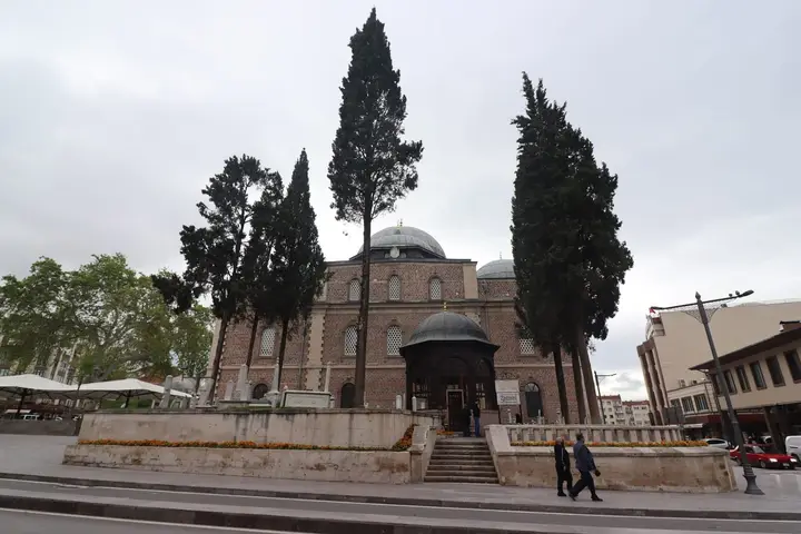
Zağnos Paşa Mosque

Built in 1461 by Zağnos Paşa, vizier of Mehmed the Conqueror, this is the largest mosque in Balıkesir and the symbol of the city. During the War of Independence Mehmet Akif Ersoy called on the people to resist here, and Mustafa Kemal Paşa delivered his famous Balıkesir Sermon in this mosque.

View on map

Natural Wonders 6

Şeytan Sofrası (Devil's Table) Photo: BIYIKLI, Türkçe Vikipedi (GFDL) · Source
Nature

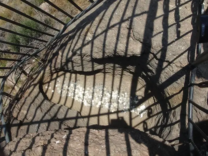
Şeytan Sofrası (Devil's Table)

A table-shaped hill formed from the lava deposits of an extinct volcano, 8 km south of Ayvalık. With views of the Ayvalık Islands and Lesbos, it is the most popular spot for watching the sunset. Visitors toss coins into the caged 'devil's footprint' and make a wish.

View on map
Nature

Ayvalık Islands Nature Park

A 17,950-hectare nature park established in 1995 and covering 19 islands, where 752 plant species and 671 marine species have been recorded. It is ideal for boat trips and diving.

View on map
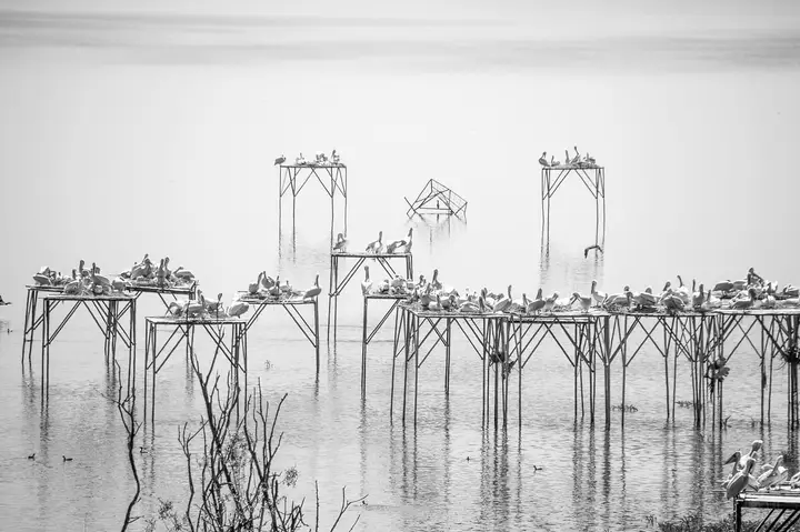
Birds on nesting platforms at Lake Manyas Photo: Ibrahimarslanca (CC BY-SA 4.0) · Source
Nature

Kuşcenneti National Park (Bird Paradise)

A national park on the north-eastern shore of Lake Manyas (Manyas Kuş Gölü). It was discovered in 1938 by the zoologist Curt Kosswig and in 1975 received the Council of Europe's Class A European Diploma. It is reached by a 3-km road that branches off at km 15 of the Bandırma–Balıkesir road; from the observation tower you can watch colonies of pelicans, cormorants and herons.

View on map
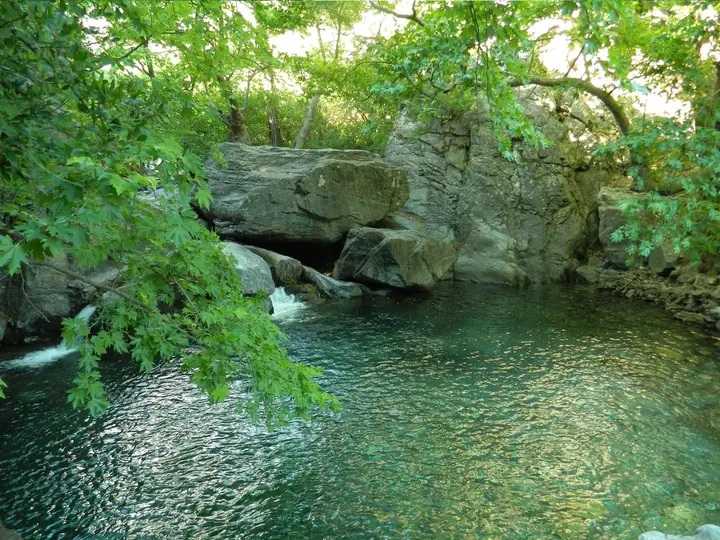
Stream and pond in Kazdağı National Park Photo: Kirmazeytin (CC BY-SA 4.0) · Source
Nature

Kazdağı National Park and Hasanboğuldu

This national park in Edremit is home to 29 local endemic species, above all the Kazdağı fir, which grows only on this mountain. The Pınarbaşı and Hasanboğuldu picnic areas are the main places to visit; the legend of Sarıkız and her tomb are also within the park.

View on map
Nature

Marmara Island

The second-largest island of Türkiye after Gökçeada; its ancient name is Prokonnesos. Its white marble, quarried since antiquity, is so famous that it gave its name to the sea and the region. In summer it can be reached by sea bus from Istanbul.

View on map
Değirmenboğazı Photo: Özge (CC BY-SA 4.0) · Source
Nature

Değirmenboğazı Nature Park

A wooded recreation area stretching along a stream near the centre of Balıkesir.

View on map

Beaches and Coves 3

Beach

Avşa Island

An island 7 km long and 4 km wide, part of the Marmara district, known for its beaches and its registered Ada Karası grape. A few thousand people live on the island in winter, but its population reaches 100,000 in summer.

View on map
Beach

Erdek and the Kapıdağ Peninsula

Erdek, on the western shore of the Kapıdağ Peninsula, is one of the oldest seaside resorts on the Marmara; it is known for the peninsula's coves and the registered Kapıdağ purple onion.

View on map
Badavut beach Photo: Erika Praefcke (CC BY 1.0) · Source
Beach

Badavut and Sarımsaklı Beaches

Long beaches south of Ayvalık, lying at the foot of Şeytan Sofrası.

View on map

Getting to Know Balıkesir

Balıkesir is the only province in Türkiye with coasts on both the Aegean and the Marmara. It has a long coastline stretching between the Gulf of Edremit and the Ayvalık Islands in the south-west and the Kapıdağ Peninsula and the Marmara Islands in the north; inland lie broad plains, Lake Manyas (Manyas Kuş Gölü) and the eastern slopes of the Kaz Mountains.

In antiquity this land was the region of Mysia: Kyzikos, south of Kapıdağ, was one of the most powerful port cities on the Marmara; Antandros, near Altınoluk, was a Troad city enriched by the timber of the Kaz Mountains; and the name Edremit comes from ancient Adramytteion on the shore of the gulf. In the 14th century the Karesi Principality, which gave the region its name, was founded; the province was called Karesi until 1926.

During the War of Independence Balıkesir was one of the centres where the Kuvâ-yi Milliye (National Forces) were organised: the Balıkesir Congresses held in 1919–1920 laid the foundations of resistance on the western front. The Balıkesir Sermon, which Mustafa Kemal Paşa delivered in the Zağnos Paşa Mosque in 1923, was also read in this city.

When to Go

In Balıkesir city centre summers are hot and dry and winters cool and rainy; the coastal districts are milder. Averages for 1999–2025 from the Turkish State Meteorological Service (Balıkesir city centre):

Month Avg. high Avg. low Rainfall Rainy days
January 9.4 °C 1.0 °C 87 mm 14
February 11.4 °C 1.7 °C 74 mm 12
March 15.2 °C 3.4 °C 63 mm 12
April 19.9 °C 6.4 °C 56 mm 9
May 25.3 °C 10.4 °C 37 mm 7
June 30.2 °C 15.1 °C 36 mm 5
July 32.8 °C 18.1 °C 12 mm 1
August 32.7 °C 18.6 °C 5 mm 1
September 28.9 °C 14.3 °C 27 mm 4
October 22.8 °C 9.9 °C 49 mm 7
November 16.8 °C 5.3 °C 76 mm 9
December 10.9 °C 2.6 °C 79 mm 12

June to September is ideal for the sea, the spring migration (March–May) and autumn for Kuşcenneti, and May–June and September–October for walks in the Kaz Mountains. The olive harvest takes place in November–December, which is the best time to taste freshly pressed olive oil in Ayvalık and Edremit.

How to Get to Balıkesir

By air: For the Aegean coast, Balıkesir Koca Seyit Airport in Edremit (4 km from Edremit centre) is the closest airport to Ayvalık, Akçay and Altınoluk.

By sea and rail: Ferries and sea buses run from Istanbul to Bandırma, and trains from Bandırma go to Izmir via Balıkesir. In summer sea buses run daily from Istanbul to the Marmara and Avşa islands.

By road: The Istanbul–Izmir motorway passes through Balıkesir; Ayvalık and Edremit lie on the Izmir–Çanakkale coastal road.

Balıkesir Area by Area

  • Central district (Karesi and Altıeylül): the Zağnos Paşa Mosque, the Clock Tower dating from 1827 and Değirmenboğazı Nature Park.
  • Ayvalık and Cunda: the old town, on the UNESCO Tentative List since 2017 for its stone houses and narrow streets, Taksiyarhis Church, Şeytan Sofrası and the 19-island Ayvalık Islands Nature Park.
  • Gulf of Edremit (Edremit, Burhaniye, Gömeç, Havran): Kazdağı National Park, Hasanboğuldu, Antandros, the beaches of Akçay and Altınoluk, and olive groves.
  • Marmara coast (Bandırma, Erdek, Gönen, Manyas): Kuşcenneti National Park, Kyzikos, the Kapıdağ Peninsula and the Gönen hot springs.
  • Islands: the ancient marble quarries of Marmara Island and the beaches of Avşa.

Suggested Itineraries

Aegean route (3 days): Stone streets in Ayvalık and Taksiyarhis Church on Cunda; the next day, sunset at Şeytan Sofrası and a boat tour of the islands; on the third day, a walk to Hasanboğuldu in Kazdağı National Park and Antandros near Altınoluk.

Marmara route (2 days): From Bandırma to Kuşcenneti National Park, then the remains of the Temple of Hadrian at Kyzikos; on the second day, Erdek and the coves of Kapıdağ.

Balıkesir Cuisine

According to TÜRKPATENT records, Balıkesir has 46 registered geographical indications. The highlights are the Ayvalık, Edremit and Burhaniye olive oils, Edremit Körfezi yeşil çizik zeytini (Gulf of Edremit green scored olives), Balıkesir höşmerim tatlısı (cheese and semolina dessert), Balıkesir kaymaklısı (clotted-cream dessert), Susurluk ayranı and tostu, Balıkesir düğün çorbası (wedding soup), Balıkesir tombul bamyası (plump okra), Gönen pirinci (Gönen rice), the Manyas, İvrindi and Savaştepe Mihaliç kelle cheeses, Ayvalık lor tatlısı (curd-cheese dessert) and sakızlı kurabiyesi (mastic biscuits), Havran siyah inciri (Havran black figs), Sındırgı çıtır kavunu (Sındırgı crisp melon) and Avşa ada karası üzümü (Avşa Ada Karası grapes).

Practical Tips

  • Ayvalık and Cunda become very crowded at summer weekends; book boat tours and accommodation early.
  • You can watch the birds best from the observation tower at Kuşcenneti early in the morning; bring binoculars.
  • Lighting fires is forbidden in the Kaz Mountains in summer because of the risk of forest fires.
  • In the summer season the car ferries to the Marmara and Avşa islands can be full; buy your ticket in advance.
Districts of Balıkesir

Balıkesir province has 20 districts. Explore the places to visit, local dishes and transport in each one.

What to Eat in Balıkesir

All dishes →
  • Balıkesir Höşmerim (cheese and semolina dessert)

    A dessert made with cheese, semolina and syrup, with a registered geographical indication.

  • Balıkesir Kaymaklısı (clotted-cream dessert)

    A clotted-cream dessert with a registered geographical indication.

  • Susurluk Ayranı and Tostu

    Frothy Susurluk ayran, served with the Susurluk toasted sandwich (tost); both are registered.

  • Balıkesir Düğün Çorbası (wedding soup)

    A traditional soup with a registered geographical indication.

  • Ayvalık Lor Tatlısı (curd-cheese dessert)

    An Ayvalık dessert made with lor (curd) cheese, with a registered geographical indication.

  • Balıkesir Tombul Bamyası (Balıkesir plump okra)

    Small-podded okra registered with a protected designation of origin.

What to eat in Balıkesir: the full food guide

Balıkesir: Frequently Asked Questions

What are the best places to visit in Balıkesir?

The main stops are Ayvalık Old Town and Cunda Island, Taksiyarhis Church, Şeytan Sofrası, Kazdağı National Park, Kuşcenneti National Park, Kyzikos, Antandros, the Zağnos Paşa Mosque, the Clock Tower, Erdek and the Marmara and Avşa islands.

Is Balıkesir the province with coasts on both the Aegean and the Marmara?

Yes. Balıkesir is the only province in Türkiye with coasts on both the Aegean and the Marmara: Ayvalık and Edremit are on the Aegean, while Bandırma, Erdek and Marmara Island are on the Marmara.

How do I get to Ayvalık?

The nearest airport is Balıkesir Koca Seyit Airport in Edremit. Ayvalık lies on the Izmir–Çanakkale coastal road.

What is Balıkesir famous for?

Höşmerim, kaymaklı, Susurluk ayran and tost, Ayvalık and Edremit olive oil, kelle cheeses, tombul okra and Ayvalık lor tatlısı; the province has 46 registered geographical indications.

When is the best time to visit Kuşcenneti?

Spring (March–May) and autumn, when bird migration is at its peak, are the best times; the best time to watch the birds is early in the morning.

What was Balıkesir's old name?

Until 1926 the province was called Karesi, after the Karesi Principality founded in the region in the 14th century.

More from the Balıkesir Guide

Other Provinces in the Marmara Region

Sources

The information in this guide has been compiled from and checked against the sources below (last checked: 7 October 2026). If you spot an error, please let us know.

  1. Vikipedi – Balıkesir
  2. Meteoroloji Genel Müdürlüğü – Balıkesir il istatistikleri
  3. Vikipedi – Ayvalık
  4. Vikipedi – Cunda
  5. Vikipedi – Taksiyarhis Kilisesi
  6. Vikipedi – Şeytan Sofrası
  7. Vikipedi – Ayvalık Adaları Tabiat Parkı
  8. Vikipedi – Zağnos Paşa Camii
  9. Vikipedi – Balıkesir Saat Kulesi
  10. Vikipedi – Kuşcenneti Millî Parkı
  11. Vikipedi – Manyas Kuş Gölü
  12. Vikipedi – Kizikos
  13. Vikipedi – Kazdağı Millî Parkı
  14. Vikipedi – Antandros
  15. Vikipedi – Adramitteion
  16. Vikipedi – Marmara Adası
  17. Vikipedi – Avşa
  18. Vikipedi – Balıkesir Koca Seyit Havalimanı
  19. Vikipedi – Karesi Beyliği
  20. Vikipedi – Hasan Basri Çantay
  21. Vikipedi – Kurtdereli Mehmet Pehlivan
  22. Vikipedi – Türkiye'de tescilli coğrafi işaretler listesi
  23. TÜRKPATENT – Ayvalık Zeytinyağı
  24. TÜRKPATENT – Balıkesir Höşmerim Tatlısı
  25. TÜRKPATENT – Susurluk Ayranı

Search 81 province guides and 968 district guides.