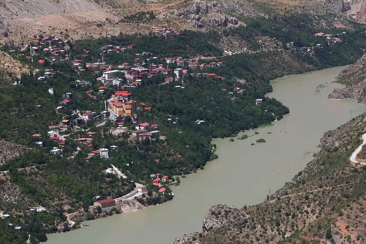
Kemaliye (Eğin)
A historic amphitheatre-shaped town that climbs the slope from the Euphrates bank, from 845 to 1,100 metres. It is famous for its wooden and stone Eğin houses among mulberry trees. Until 1922 its name was Eğin.
View on map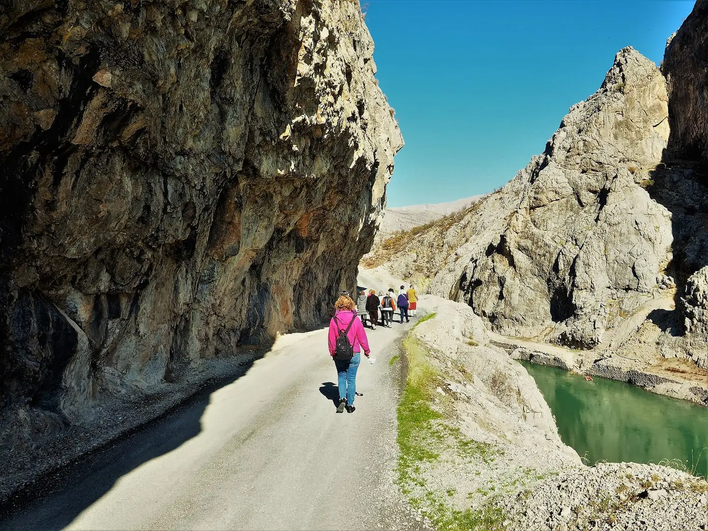 Photo: Bodrumlu60 (CC BY-SA 4.0) · Source
 Erzincan is the land where the Euphrates rises, with the 25-km-long, 1,000-metre-deep Karanlık Canyon and the Taş Yol cut into the rock, Kemaliye (Eğin), which joined the UNESCO Tentative List in 2021, the Urartian fortress of Altıntepe, Kemah Castle on its rock, the Saltukid Mama Hatun Tomb, Girlevik Waterfall and the Ergan Mountain ski resort. Erzincan tulum cheese and Kemaliye mulberries have registered geographical indications.
Last updated:
10 places worth seeing in Erzincan, from historic monuments to natural wonders, grouped by type. Open any of them on the map with a single click.
A historic amphitheatre-shaped town that climbs the slope from the Euphrates bank, from 845 to 1,100 metres. It is famous for its wooden and stone Eğin houses among mulberry trees. Until 1922 its name was Eğin.
View on mapThe historic road to Kemaliye, passing through tunnels cut into the walls of Karanlık Canyon; the most impressive views of the canyon are seen from this road.
View on map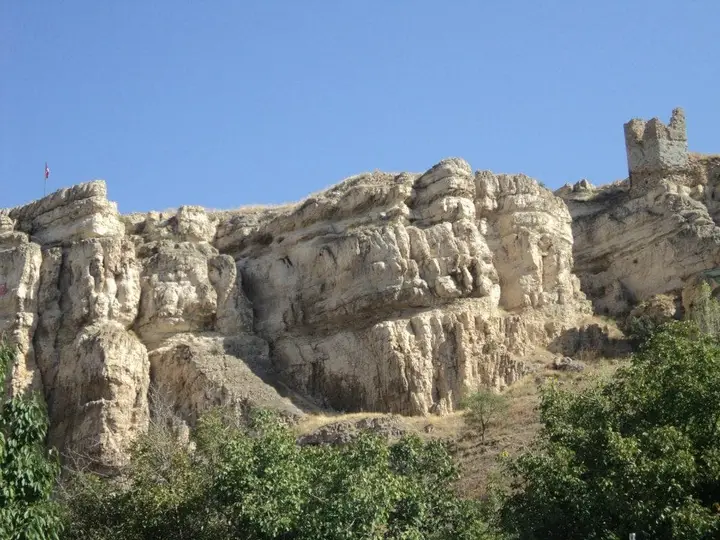 Photo: Nidayi (CC BY-SA 4.0) · Source
 A castle on a rock 80 metres high at Kemah, dated to around 205 BC. It passed from the Safavids to the Ottomans with the Siege of Kemah in 1515. Excavation and restoration work is continuing.
View on map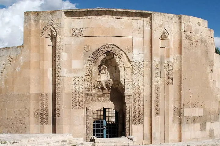 Photo: Bertramz (CC BY 3.0) · Source
 A tomb (kümbet) at Tercan, attributed to the Saltukid ruler Mama Hatun and dating from the late 12th or early 13th century. With its unique plan, rising in the middle of a circular courtyard, and its stone decoration, it is one of the most original tombs in Anatolia. A caravanserai and a hammam stand beside it.
View on map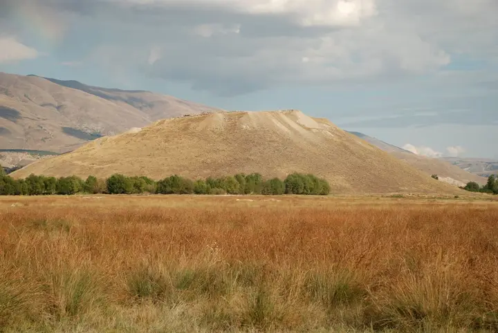 Photo: Bertramz (CC BY-SA 3.0) · Source
 An Urartian fortress at Üzümlü, on a volcanic cone rising 60 metres above the plain. Excavations in 1959–1967 uncovered a temple, an apadana and rich tombs. It is one of the important examples of Urartian architecture.
View on map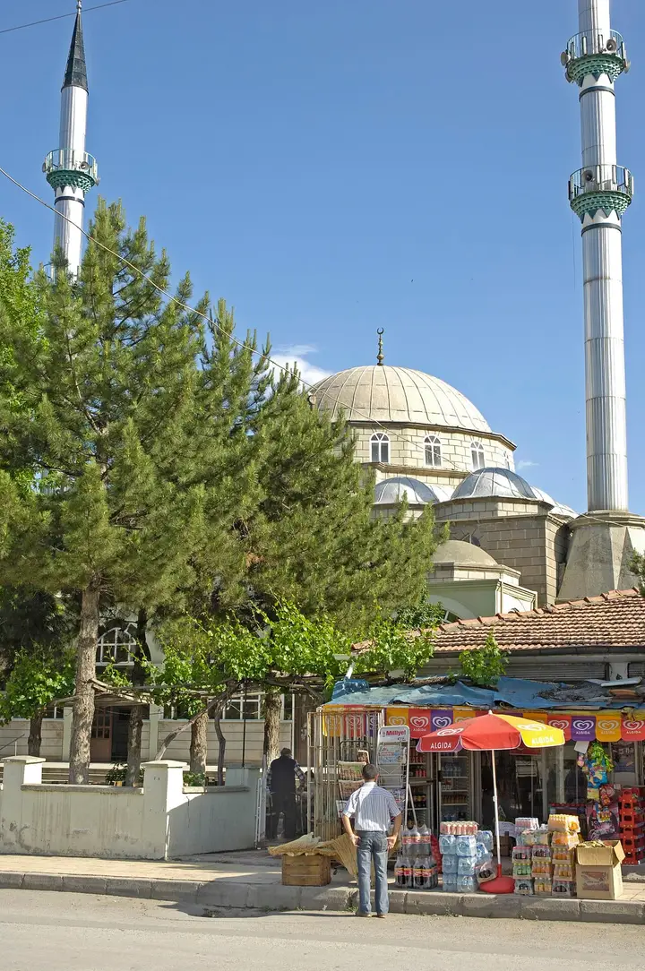 Photo: Dosseman (CC BY-SA 4.0) · Source
 A tomb in the city centre for Mehmed Vehbi (Terzi Baba), a 19th-century Naqshbandi sheikh originally from Erzincan; it is one of the most visited spiritual places in the city.
View on map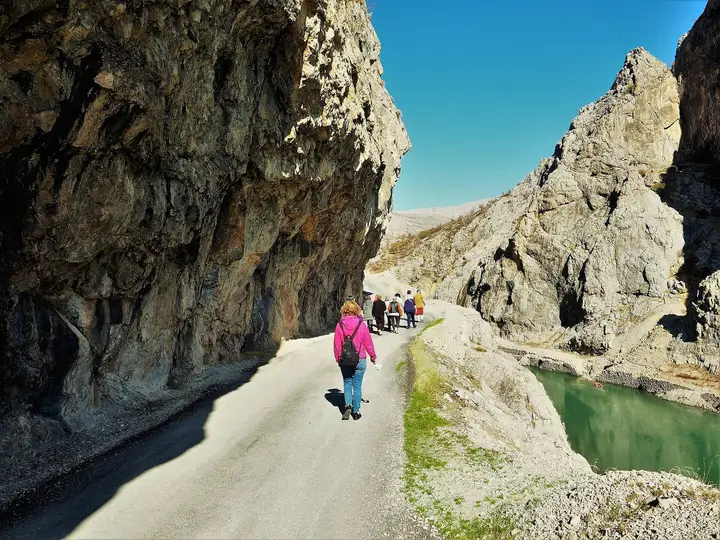 Photo: Bodrumlu60 (CC BY-SA 4.0) · Source
 A 25-km-long, 1,000-metre-deep canyon at Kemaliye, cut by the Karasu (Euphrates) through the Munzur Mountains between the village of Bağıştaş in İliç and the village of Dutluca in Kemaliye; its slopes reach a gradient of 90%. It joined the UNESCO Tentative List in 2021 together with Kemaliye.
View on map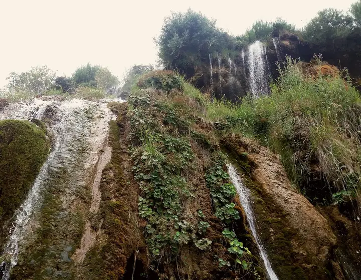 Photo: Medgeorgia (CC BY-SA 4.0) · Source
 A waterfall in the town of Çağlayan, 30 km south-east of Erzincan, which drops 30–40 metres in three stages. In winter it freezes and becomes an ice-climbing area. It was declared a natural protected area in 1990.
View on mapA ski resort on the slopes of Ergan Mountain, 12 km south of Erzincan. With its cable car and chairlift lines, it has some of the longest lifts in Türkiye.
View on mapErzincan lies in the north-west of Eastern Anatolia, on a plain crossed by the Karasu (Euphrates) River and ringed by mountains. Altıntepe, on the edge of the plain, is one of the most important fortresses of the Urartian period; excavations have uncovered a temple, an apadana and tomb chambers. In the Middle Ages the city flourished under the Saltukids, the Mengujekids and the Seljuks; the Mama Hatun Tomb and Caravanserai at Tercan is one of the most original buildings of this period.
The event that most deeply affected Erzincan’s recent history was the earthquake of 27 December 1939, with a magnitude of 7.9. According to official figures, 32,968 people lost their lives, the city was largely destroyed and it was moved to its present site. Regarded as the first of a series of major earthquakes on the North Anatolian Fault, it was one of the most devastating disasters in Türkiye’s history.
The tourism star of the province is Kemaliye (formerly Eğin). Together with the Karanlık Canyon that the Euphrates has cut through the Munzur Mountains, the historic Eğin houses spread over the slopes like an amphitheatre and the Taş Yol passing through tunnels cut into the rock, it was added to the UNESCO World Heritage Tentative List in 2021.
Erzincan has a continental climate: winters are cold and snowy, summers hot and dry. Averages for 1928–2025 from the Turkish State Meteorological Service:
| Month | Avg. high | Avg. low | Rainfall | Rainy days |
|---|---|---|---|---|
| January | 1.8 °C | −6.8 °C | 28 mm | 9 |
| February | 3.8 °C | −5.3 °C | 30 mm | 9 |
| March | 9.6 °C | −0.7 °C | 43 mm | 11 |
| April | 16.9 °C | 4.8 °C | 53 mm | 13 |
| May | 22.3 °C | 8.8 °C | 54 mm | 14 |
| June | 27.1 °C | 12.3 °C | 31 mm | 9 |
| July | 31.5 °C | 15.6 °C | 12 mm | 3 |
| August | 32.1 °C | 15.5 °C | 7 mm | 2 |
| September | 27.5 °C | 11.0 °C | 16 mm | 4 |
| October | 20.0 °C | 5.9 °C | 39 mm | 8 |
| November | 11.7 °C | 0.8 °C | 35 mm | 8 |
| December | 4.5 °C | −3.9 °C | 28 mm | 9 |
May–June and September–October are ideal for Kemaliye and the canyon, and December–March for skiing. Kemaliye’s mulberries ripen in June. The lowest temperature ever recorded is −31.2 °C; in winter Girlevik Waterfall freezes and becomes an ice-climbing area.
By air: Erzincan Yıldırım Akbulut Airport is 9 km from the city centre.
By train: The Eastern Express and the Erzurum–Ankara trains pass through Erzincan.
By road: Erzincan lies on the Sivas–Erzurum road. Kemaliye is 152 km from the provincial centre and Elazığ is 144 km away; Kemaliye is reached via the Taş Yol.
Day 1 – Merkez: The Urartian fortress of Altıntepe in the morning; Girlevik Waterfall in the afternoon; Erzincan tulum cheese and kesme kadayıf in the evening.
Days 2–3 – Kemaliye: Descend from the Taş Yol into Karanlık Canyon for a canyon walk or a boat tour; stay in Eğin’s historic houses among the mulberry trees and try the lök dessert.
On the way back: Kemah Castle, and the Mama Hatun Tomb at Tercan.
Erzincan’s most famous product is Erzincan tulum peyniri (tulum cheese), matured in a tulum made of goat or sheep skin. The other registered products are Erzincan kesme kadayıfı, Erzincan sütlacı (rice pudding), Erzincan üzümlü sarucu (sarucu with raisins), cimin üzümü (Cimin grapes), Kemaliye dutu (Kemaliye mulberries) and its kuru kaymağı (dried clotted cream), Kemaliye lök tatlısı, Erzincan geven balı (tragacanth honey), the honeys of Refahiye and Tercan, Kemah doğal kaynak tuzu (Kemah natural spring salt) and Ekşisu doğal maden suyu (natural mineral water). Among handicrafts, Erzincan bakır işçiliği (copperwork), Kemaliye gazenne dokuması (gazenne weaving), Kemaliye kapı tokmağı (door knockers) and the Cengerli kilimi are registered.
Erzincan province has 9 districts. Explore the places to visit, local dishes and transport in each one.
A cheese with a registered geographical indication, matured in a skin tulum.
Kadayıf with a registered geographical indication.
An Eğin dessert with a registered geographical indication.
A local dish with a registered geographical indication.
A rice pudding (sütlaç) with a registered geographical indication.
The main stops are Kemaliye, Karanlık Canyon and the Taş Yol, Girlevik Waterfall, Altıntepe, Kemah Castle, the Mama Hatun Tomb, Ergan Mountain Ski Resort, the Grand Mosque and the Terzi Baba Tomb.
It is in the Kemaliye district of Erzincan, a 25-km-long, 1,000-metre-deep canyon cut by the Karasu (Euphrates) through the Munzur Mountains.
Kemaliye and Karanlık Canyon were added to the UNESCO World Heritage Tentative List in 2021.
Erzincan tulum cheese, kesme kadayıf, Kemaliye mulberries and lök dessert, copperwork and honey.
The earthquake of 27 December 1939 had a magnitude of 7.9; according to official figures, 32,968 people lost their lives.
May–June and September–October are best for Kemaliye, and December–March for skiing.
The information in this guide has been compiled from and checked against the sources below (last checked: 7 October 2026). If you spot an error, please let us know.