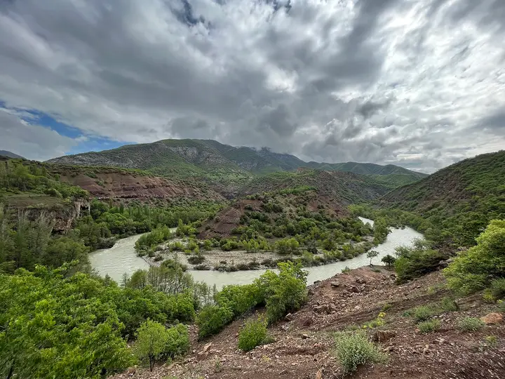
 Photo: Crumou (CC BY-SA 4.0) · Source
 Munzur Valley National Park
A 42,000-hectare national park between Tunceli and Ovacık, declared in 1971; it is known for its stream sources and springs, endemic plant species and wildlife.
View on map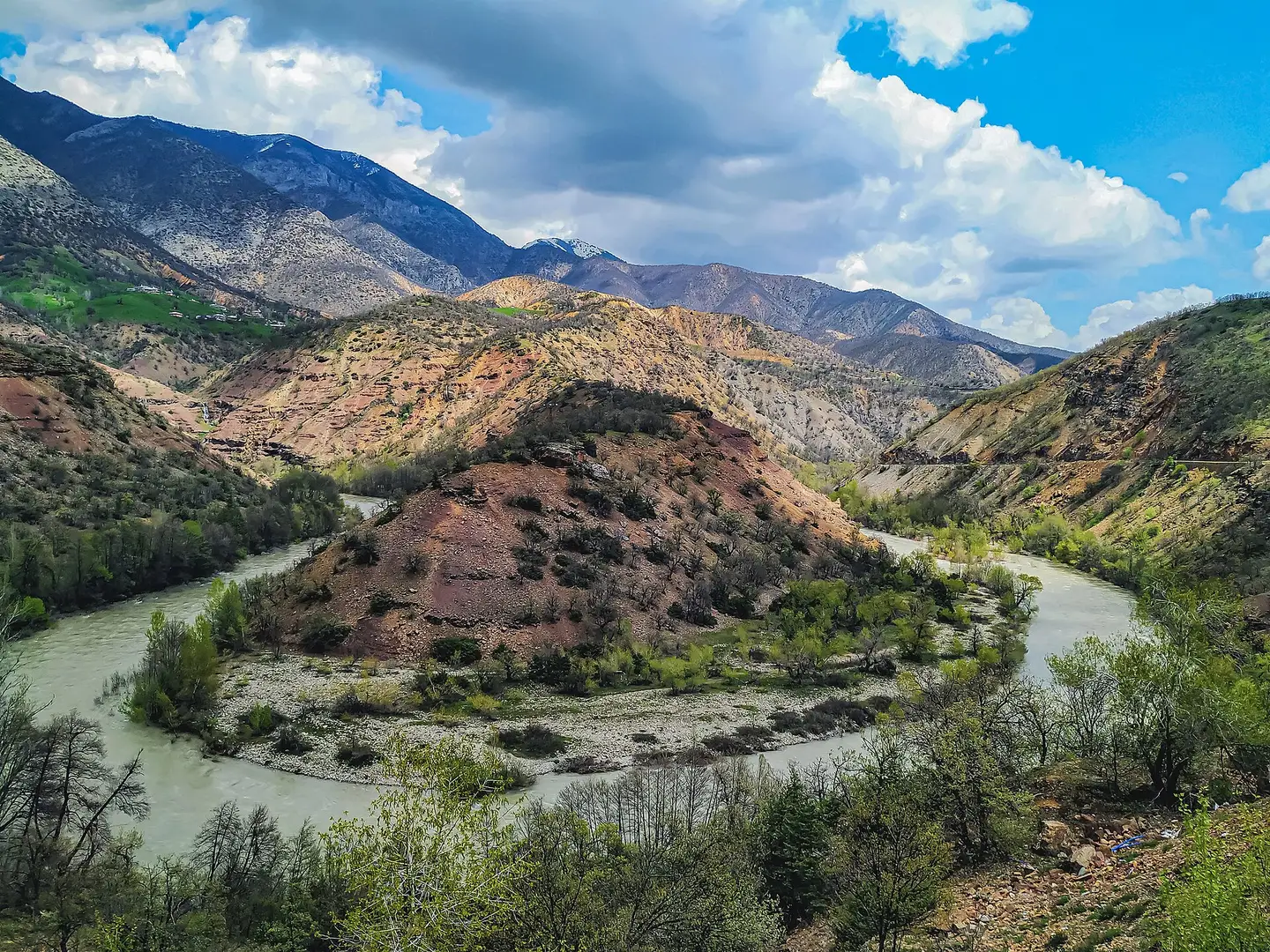 Photo: Candan Özgen Kruşa (CC BY-SA 4.0) · Source
 Tunceli, formerly known as Dersim, lies between the Munzur Mountains and the Euphrates basin and, with the 42,000-hectare Munzur Valley National Park, is one of Türkiye's most secluded provinces for nature. Its highlights are the Munzur Springs, Pertek Castle overlooking Keban Dam Lake, the Pülümür Valley and the history of Hozat. Munzur honey, Tunceli garlic, Çemişgezek Ulukale mulberries and Şorbik soup are registered.
Last updated:
6 places worth seeing in Tunceli, from historic monuments to natural wonders, grouped by type. Open any of them on the map with a single click.
Photo: Crumou (CC BY-SA 4.0) · Source A 42,000-hectare national park between Tunceli and Ovacık, declared in 1971; it is known for its stream sources and springs, endemic plant species and wildlife.
View on map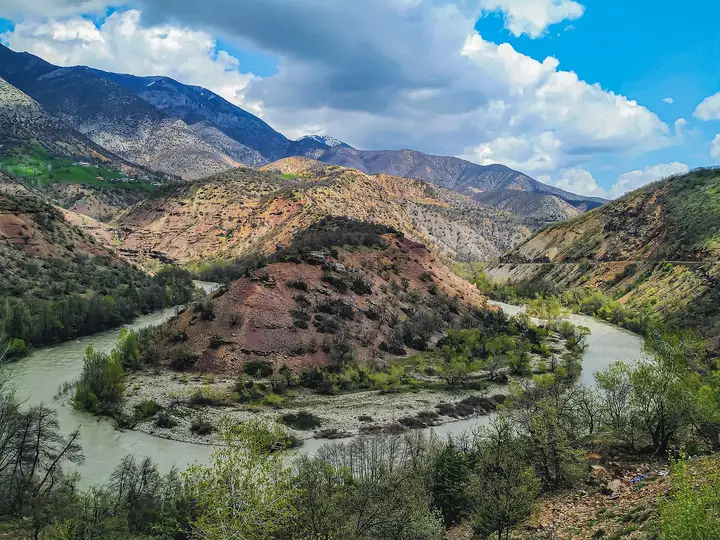 Photo: Candan Özgen Kruşa (CC BY-SA 4.0) · Source
 Mountain ranges that stretch for about 130 km from the north-west to the north-east of the province and are difficult to cross.
View on map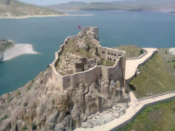 Photo: Ferman bey (CC BY-SA 3.0) · Source
 A castle on a pointed rock on the bank of the Murat River, which took on the look of an island when Keban Dam Lake was filled. It includes structures left from the time when the Mengujekids dominated the region after 1071, and is also thought to have been built in the Urartian period.
View on mapThe springs at the source of the Munzur Stream in Ovacık, associated with the legend of Munzur Baba.
View on mapTunceli lies in the Upper Euphrates Basin of Eastern Anatolia, in a rugged landscape between the Munzur Mountains, the Karasu, the Bingöl Mountains and Keban Dam Lake. The Munzur Mountains stretch for about 130 km from the north-west of the province to the north and north-east; the most important valleys in the province are those of the Munzur, Mercan, Pülümür, Peri and Tahar streams. The province lies entirely within the Euphrates Basin and is surrounded by natural boundaries.
Tunceli’s historical name is Dersim. The region was settled in the Chalcolithic Age (5500–3500 BC) and passed through the Hurrian-Mitanni period (Išuwa) and the Urartian era. Under Ottoman rule, in 1847 it was attached to Erzurum as the “Dersim Sanjak” with Hozat as its centre, and in 1879 it became a separate province under the name Dersim. In the Republican period, the province was renamed Tunceli by Law No. 2884, “on the Administration of the Province of Tunceli”, passed on 25 December 1935, and the provincial centre was moved to the village of Mamiki.
The province’s most important natural asset is Munzur Valley National Park: the 42,000-hectare area, declared in 1971, is known for its springs, endemic plant species and wildlife. It stretches between Tunceli and Ovacık. Pertek Castle, standing like an island in the middle of Keban Dam Lake on the Murat River, is known for structures left from the time when the Mengujekids dominated the region after 1071; the castle is also thought to have been built in the Urartian period.
Tunceli has a continental climate: winters are cold and snowy, summers very hot. Averages for 1960–2025 from the Turkish State Meteorological Service:
| Month | Avg. high | Avg. low | Rainfall | Rainy days |
|---|---|---|---|---|
| January | 3.2 °C | −5.3 °C | 128 mm | 12 |
| February | 5.3 °C | −3.9 °C | 105 mm | 12 |
| March | 11.5 °C | 1.1 °C | 116 mm | 13 |
| April | 18.4 °C | 6.3 °C | 104 mm | 14 |
| May | 24.1 °C | 10.1 °C | 73 mm | 13 |
| June | 30.2 °C | 14.5 °C | 18 mm | 5 |
| July | 35.2 °C | 18.9 °C | 6 mm | 2 |
| August | 35.5 °C | 18.5 °C | 5 mm | 1 |
| September | 30.7 °C | 13.4 °C | 17 mm | 3 |
| October | 22.9 °C | 8.2 °C | 62 mm | 8 |
| November | 13.7 °C | 2.1 °C | 101 mm | 9 |
| December | 5.9 °C | −2.2 °C | 133 mm | 12 |
The best periods are May to June and September to October. These measurements are for Tunceli city centre; the high parts of the Munzur Mountains and the highland pastures are much cooler. Highland roads may be closed by snow throughout the winter.
By road: Tunceli is linked by road to Elazığ, Erzincan and Bingöl; the road to Pertek leaves from Elazığ, on the opposite shore of Keban Dam Lake. There is no airport with scheduled passenger flights within the province; the airports of neighbouring provinces are used.
Day 1 – Munzur Valley: From Tunceli centre towards Ovacık, a walk along the Munzur Stream and the Munzur Springs.
Day 2 – Pertek: Pertek Castle on the shore of Keban Dam Lake, with views over the lake.
Day 3 – Çemişgezek and Nazımiye: Highland villages and mountain roads.
Tunceli cuisine is based on mountain and highland produce. The delicacy with a registered geographical indication is Tunceli Şorbik çorbası (Şorbik soup). The products are Munzur balı (Munzur honey), Tunceli sarımsağı (Tunceli garlic), Çemişgezek Ulukale dutu (Çemişgezek Ulukale mulberries) and Tunceli Pülümür yer altı kaynak tuzu (Tunceli Pülümür underground spring salt).
Tunceli province has 8 districts. Explore the places to visit, local dishes and transport in each one.
A soup with a registered geographical indication.
The main stops are Munzur Valley National Park, the Munzur Springs, Pertek Castle, the Pülümür Valley and Hozat.
It was Dersim; the name was changed to Tunceli on 25 December 1935 by Law No. 2884.
The Munzur Valley, Munzur honey, Tunceli garlic and Çemişgezek Ulukale mulberries.
It covers 42,000 hectares and was declared a national park in 1971.
May to June and September to October are the best periods.
The information in this guide has been compiled from and checked against the sources below (last checked: 8 October 2026). If you spot an error, please let us know.