 Photo: Acar54 (CC BY-SA 4.0) · Source
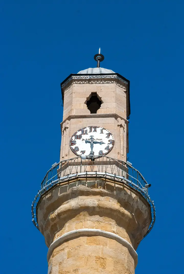
 Çorum Clock Tower
A 27.5-metre minaret-shaped tower built between 1894 and 1896 by Yedi Sekiz Hasan Paşa. It is the symbol of the city.
View on map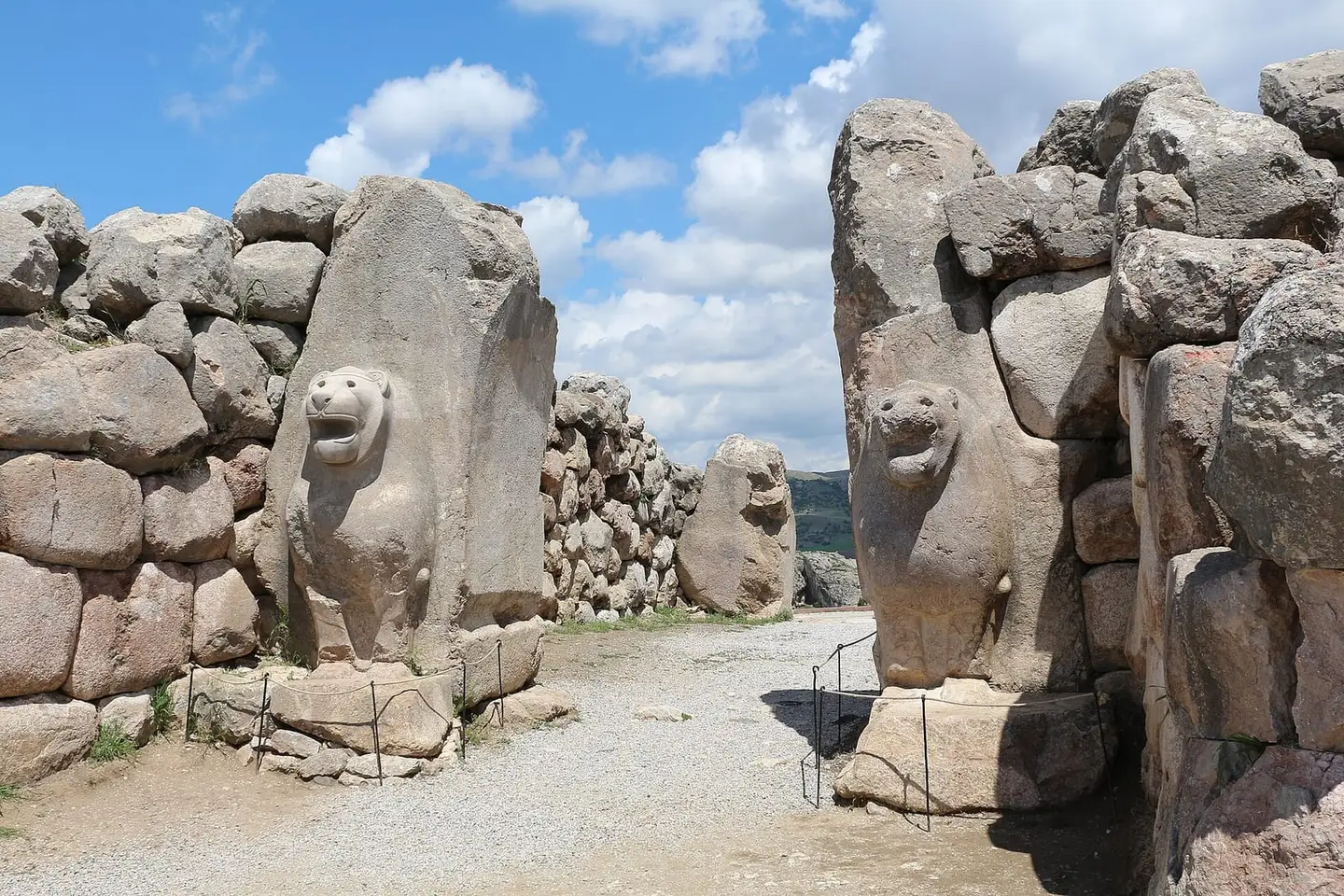 Photo: Bernard Gagnon (CC BY-SA 3.0) · Source
 Çorum is the heart of Hittite civilisation, with the Hittite capital Hattuşa and the Yazılıkaya open-air sanctuary (both UNESCO World Heritage since 1986), Alacahöyük with its Sphinx Gate, and Şapinuva with its 4,000 tablets. The Hittite version of the Treaty of Kadesh, the oldest known peace treaty in the world, was found at Hattuşa. The province is also known for the Koyunbaba Bridge over the Kızılırmak, İskilip Castle and the famous Çorum leblebi (roasted chickpeas).
Last updated:
14 places worth seeing in Çorum, from historic monuments to natural wonders, grouped by type. Open any of them on the map with a single click.
Photo: Acar54 (CC BY-SA 4.0) · Source A 27.5-metre minaret-shaped tower built between 1894 and 1896 by Yedi Sekiz Hasan Paşa. It is the symbol of the city.
View on map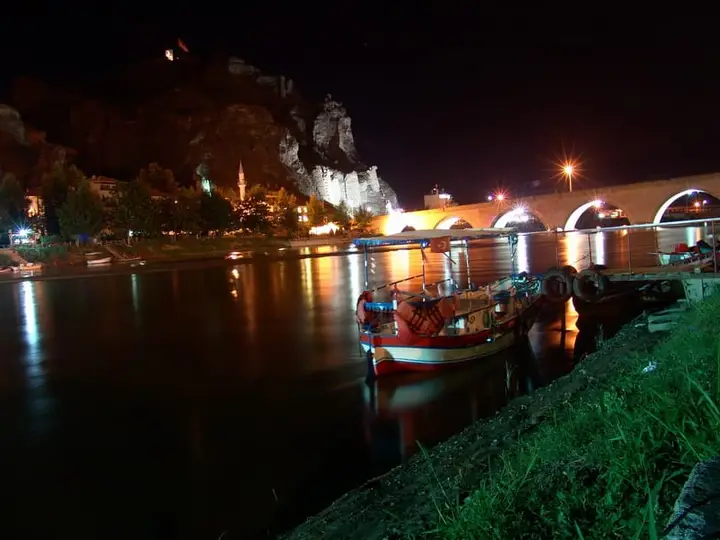 Photo: Yesilordek (CC BY 3.0) · Source
 A 19-arched stone bridge over the Kızılırmak at Osmancık, built in the reign of Bayezid II. It is one of the longest bridges of the Ottoman period.
View on map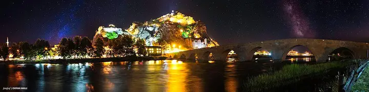 Photo: Emrahakilli (CC BY-SA 4.0) · Source
 A castle on a wedge-shaped rock north of the Kızılırmak, on the site of the Roman settlement of Pimolisa.
View on map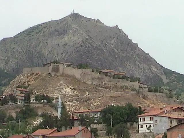
A rocky castle overlooking İskilip from above, with traditional mansions at its foot. With its dolma and tepsi dishes, the district is one of the richest corners of Çorum cuisine.
View on map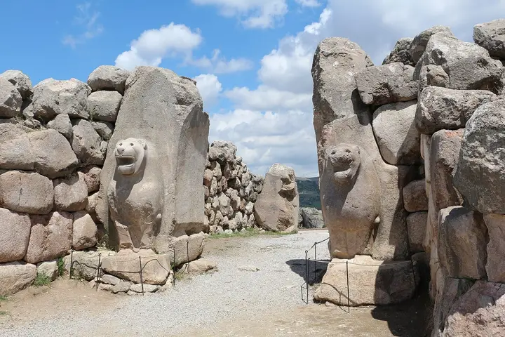 Photo: Bernard Gagnon (CC BY-SA 3.0) · Source
 The Hittite capital, 82 km south-west of Çorum and 4 km east of Boğazkale. It was the centre of the empire from the 17th to the 13th century BC and became a UNESCO World Heritage Site in 1986. With its walls, Lion Gate, King's Gate, Yerkapı tunnel and more than 30 temples, it is the most important Bronze Age city in Anatolia.
View on map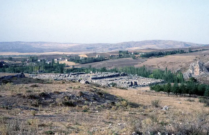 Photo: Dosseman (CC BY-SA 4.0) · Source
 The Great Temple in the Lower City, measuring 65 × 42 metres and thought to have been dedicated to the Storm God and the Sun Goddess. In a small room at its southern end stands the 'Green Stone', a cubic block of nephrite whose purpose is unknown.
View on map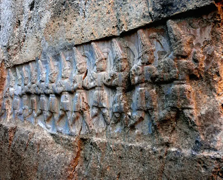
The Hittite open-air sanctuary 2 km north-east of Hattuşa. The Great Gallery has reliefs of 63 gods and goddesses in procession, and the Small Gallery has reliefs of the twelve gods of the underworld and King Tudhaliya IV. It took its final form in the middle of the 13th century BC.
View on map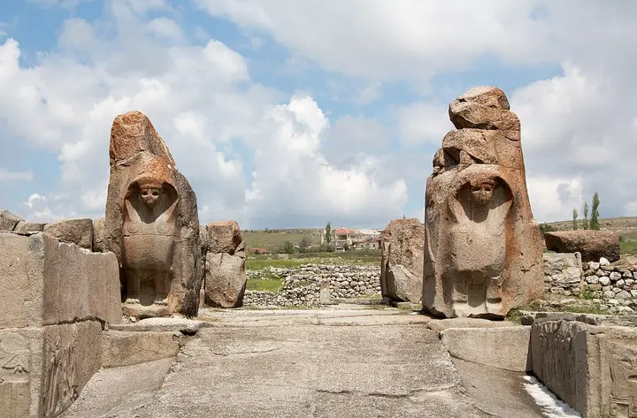 Photo: Bernard Gagnon (CC BY-SA 3.0) · Source
 A mound 15 km north-west of Alaca, where 15 building levels from four cultural phases have been identified. It is famous for the Sphinx Gate of the Hittite period and for the royal tombs of the Early Bronze Age. The first excavations were carried out by Theodor Makridi in 1907.
View on map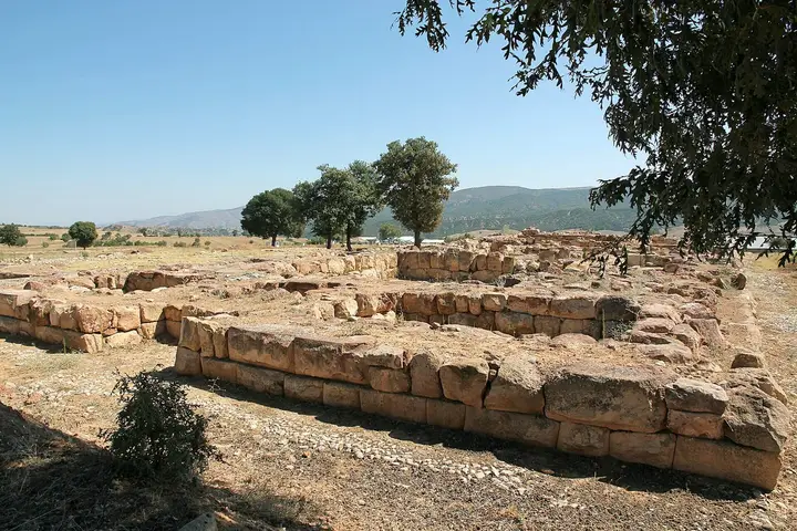 Photo: Klaus-Peter Simon (CC BY-SA 3.0) · Source
 A military and religious centre at Ortaköy, known as the second largest city of the Hittite Kingdom. Nearly 4,000 tablets and fragments written in Hittite, Hattic, Hurrian and Akkadian were found here, along with a 3,300-year-old bronze warrior's helmet.
View on mapA mosque thought to have been built in the Seljuk period at the end of the 13th century. It was repaired after earthquakes and took its present form in 1810, and its woodwork stands out.
View on map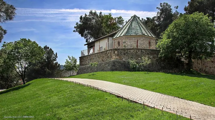 Photo: Emrahakilli (CC BY-SA 4.0) · Source
 A tomb built by Bayezid II at Osmancık for the qalandar Koyunbaba (Seyit Ali), regarded as a contemporary of Hacı Bektaş-ı Veli.
View on map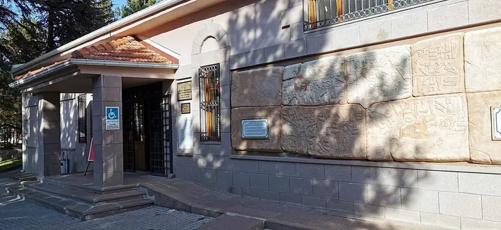 Photo: Murat Özsoy 1958 (CC BY-SA 4.0) · Source
 A museum at the entrance to Hattuşa displaying the tablets, seals and ceramics unearthed at the site.
View on map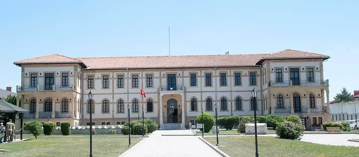 Photo: Acar54 (CC BY-SA 4.0) · Source
 A museum that has occupied the historic hospital building, completed in 1914, since 2003. Finds from the Alacahöyük, Boğazköy, Kuşsaray and Resuloğlu excavations are on display.
View on mapA 12-km-long canyon at Ortaköy carved by the Çekerek River. On the rocks above it are Hellenistic remains and a relief of the Mother Goddess holding a lion cub.
View on mapÇorum is a province set on the plateau where the Kızılırmak and Yeşilırmak basins meet, between Central Anatolia and the Black Sea. In the south-west of the province, at Boğazkale, Hattuşa was the capital of the Hittite Empire between the 17th and 13th centuries BC; the city was added to the UNESCO World Heritage List in 1986. Yazılıkaya, 2 km north-east of Hattuşa, is the Hittites’ open-air sanctuary, with 63 divine figures carved among the rocks.
Among the cuneiform tablets found in the archives of Hattuşa is the Hittite version of the Treaty of Kadesh, signed around 1259 BC between the Egyptian pharaoh Ramesses II and the Hittite king Hattusili III. It is the oldest known peace treaty for which the texts of both sides survive. The other important Hittite centres in the province are Alacahöyük, with its Sphinx Gate and Bronze Age tombs, and Şapinuva (Ortaköy), regarded as the second largest city of the Hittite Kingdom, where nearly 4,000 tablets were found.
The city centre preserves the Grand Mosque from the Seljuk and Ottoman periods and the Clock Tower of 1894–1896. Çorum is also the home of Türkiye’s most famous leblebi.
Çorum has a continental climate: summers are hot and dry, winters cold and snowy. Averages for 1929–2025 from the Turkish State Meteorological Service:
| Month | Avg. high | Avg. low | Rainfall | Rainy days |
|---|---|---|---|---|
| January | 4.4 °C | −4.2 °C | 39 mm | 12 |
| February | 6.6 °C | −3.3 °C | 29 mm | 11 |
| March | 11.5 °C | −0.7 °C | 39 mm | 12 |
| April | 17.5 °C | 3.7 °C | 47 mm | 12 |
| May | 22.2 °C | 7.6 °C | 62 mm | 13 |
| June | 26.0 °C | 10.5 °C | 54 mm | 10 |
| July | 29.2 °C | 12.6 °C | 20 mm | 4 |
| August | 29.6 °C | 12.8 °C | 15 mm | 3 |
| September | 25.6 °C | 9.3 °C | 22 mm | 5 |
| October | 20.0 °C | 5.4 °C | 27 mm | 7 |
| November | 13.0 °C | 1.0 °C | 33 mm | 8 |
| December | 6.5 °C | −1.9 °C | 43 mm | 12 |
May–June and September–October are ideal for the Hittite sites. Hattuşa is a large site with no shade, so in summer go early in the morning. In winter the sites may be covered in snow; the lowest temperature ever recorded is −27.2 °C.
By road: Çorum lies on the Ankara–Samsun road, about 3 hours from Ankara and about 2 hours from Samsun. Hattuşa is 82 km south-west of the city centre, at Boğazkale; Alacahöyük is 15 km north-west of the Alaca district.
By air: There is no airport in Çorum; the airport at Merzifon (Amasya) is the nearest, and Ankara Esenboğa can also be used.
Day 1 – The Hittite capital: Boğazköy Museum in the morning, then the Lower City and Great Temple at Hattuşa, the Lion Gate, Yerkapı (Sphinx Gate) and the King’s Gate; in the afternoon, the reliefs of Yazılıkaya.
Day 2 – Alacahöyük and Çorum: Alacahöyük and its museum in the morning; Çorum Museum, the Grand Mosque and the Clock Tower in the afternoon; leblebi stalls in the evening.
Extra day: Koyunbaba Bridge and Kandiber Castle at Osmancık; the castle and historic houses at İskilip.
The symbol of Çorum is Çorum leblebisi (roasted chickpeas). The main ones among the 34 geographical indications registered with TÜRKPATENT are Çorum kuru mantısı (dried dumplings), Çorum su böreği, Çorum baklavası, Çorum şekerlemesi (confectionery), Çorum simidi (sesame bread ring), Alaca hingali, Alaca yanıç böreği, İskilip dolması, İskilip tepsisi, İskilip baklavası, Osmancık malak tatlısı, Osmancık kapari turşusu (pickled capers), Kargı tulum peyniri (Kargı goatskin-cured cheese), Oğuzlar cevizi (Oğuzlar walnuts) and İskilip çileği (İskilip strawberries). Among handicrafts, the Alaca camili kilimi and the İskilip tokmaklı kağnı (mallet-fitted ox cart) are registered.
Çorum province has 14 districts. Explore the places to visit, local dishes and transport in each one.
Roasted chickpeas with a registered geographical indication, the symbol of Çorum.
Dumplings (mantı) with a registered geographical indication.
A slow-cooked rice-and-meat dish with a registered geographical indication.
A dough dish with a registered geographical indication.
A dessert with a registered geographical indication.
A börek with a registered geographical indication.
The main stops are Hattuşa, Yazılıkaya, Alacahöyük, Şapinuva, the Boğazköy and Çorum museums, the Clock Tower, the Grand Mosque, Koyunbaba Bridge and Kandiber Castle at Osmancık, İskilip Castle and İncesu Canyon.
Yes. Hattuşa, the Hittite capital, has been on the UNESCO World Heritage List since 1986.
Hattuşa is 82 km south-west of Çorum city centre, in the Boğazkale district.
The Hittite version of the treaty was found in the archives of Hattuşa; the tablet is on display today in the Istanbul Archaeology Museums.
Leblebi, kuru mantı, İskilip dolması, Alaca hingali, Osmancık rice and Kargı tulum cheese; the province has 34 registered geographical indications.
May–June and September–October are the best times for the Hittite sites.
The information in this guide has been compiled from and checked against the sources below (last checked: 7 October 2026). If you spot an error, please let us know.